

Best eSIM for Hokkaido: Coverage, Networks, and Traveler Tips

Hokkaido is Japan at its most expansive. Where the rest of Japan is defined by density — cities compressed onto narrow coastal plains, temples clustered in ancient capitals, bullet train lines threading through populated corridors — Hokkaido opens outward into something altogether different: broad agricultural plains, volcanic mountain ranges, national park wilderness, and ski resorts that receive snowfall measured in meters rather than centimeters. It is a destination that rewards travelers who venture beyond the obvious, and that requires connectivity planning that accounts for a geography unlike anywhere else in Japan.
The hokkaido esim question is not the same as the Tokyo or Kyoto eSIM question. In Japan’s southern cities, network coverage is comprehensive across all carriers, and the connectivity decision is primarily about data volume and price. In Hokkaido — particularly in the mountain areas, national parks, rural agricultural zones, and the dramatic coastal roads of the Shiretoko Peninsula — network selection is the critical variable that determines whether your connectivity works at all in the places your itinerary takes you.
This guide covers Hokkaido’s mobile network landscape honestly and specifically: which carrier covers which areas, what rural and mountain connectivity actually looks like, how to plan data usage on a Hokkaido road trip, and which Japan Sim Data plan gives you the connectivity foundation that Hokkaido’s exceptional geography deserves.
Why Connectivity in Hokkaido Is Different

Hokkaido occupies approximately 22% of Japan’s total land area but contains only around 4% of Japan’s population. This density inversion — vast geography, sparse population — creates a mobile network coverage landscape that differs fundamentally from Honshu’s urban-optimized infrastructure.
Mobile network towers follow population. Japan’s carriers have built exceptional coverage across the populated corridors of Tokyo, Osaka, the Tokai region, and the Shinkansen routes that connect them. In Hokkaido, that same infrastructure logic produces strong coverage in Sapporo and the major city centers, reasonable coverage in mid-sized towns and tourist destinations, and genuinely variable coverage in the rural, mountain, and national park areas that make Hokkaido special.
For a traveler whose Hokkaido itinerary extends beyond Sapporo — into Niseko’s ski terrain, Furano’s lavender fields and ski runs, the Shiretoko National Park’s wildlife coast, the Daisetsuzan mountain interior, or the long road across the Tokachi plain — connectivity planning that accounts for this geographic reality is the difference between a trip that stays connected where it matters and one that leaves you offline at exactly the moments you need navigation or communication.
Hokkaido’s Mobile Network Coverage: Docomo, SoftBank, and KDDI
NTT Docomo in Hokkaido
Docomo’s Hokkaido coverage is the most extensive of the three major carriers, and this difference is operationally significant for travelers venturing beyond Sapporo and the main tourist corridors.
Docomo’s investment in Hokkaido’s network reflects the carrier’s national coverage mandate — as Japan’s largest and most established carrier, Docomo has built coverage in Hokkaido’s regional towns, ski resorts, coastal fishing villages, and national park approach roads to a depth that SoftBank and KDDI have not matched. docomo hokkaido coverage reaches areas that are simply blank on the other carriers’ coverage maps.
For Hokkaido specifically, Docomo is the carrier recommendation that Japan Sim Data makes consistently — for ski resort coverage above the main village areas, for national park road connectivity, for the Shiretoko Peninsula, for Daisetsuzan approaches, and for the long stretches of rural road that connect Hokkaido’s highlights.
SoftBank in Hokkaido
softbank hokkaido coverage is strong in Sapporo, Hakodate, Asahikawa, and the main tourist corridors between them. For travelers whose Hokkaido itinerary is concentrated in the major cities and most-visited tourist destinations — Odori Park, the Hakodate morning market, the Asahikawa winter festival — SoftBank provides adequate connectivity.
Where SoftBank’s Hokkaido coverage weakens is in the rural and mountain areas that define Hokkaido’s character. The upper slopes of Niseko’s ski mountain, the interior of Daisetsuzan National Park, the coastal roads of Shiretoko, and the agricultural plains of central Hokkaido all represent areas where SoftBank’s coverage is less reliable than Docomo’s.
KDDI/au in Hokkaido
kddi hokkaido performance follows a similar pattern to SoftBank — strong in urban and major tourist areas, progressively less comprehensive in rural and mountain environments. KDDI has made significant network investments in recent years and its coverage gap relative to Docomo has narrowed, but for Hokkaido’s most remote and rural areas, Docomo’s coverage advantage remains.
The Network Recommendation for Hokkaido
For any Hokkaido itinerary that extends beyond Sapporo and the main city circuit, Docomo is the unambiguous network recommendation. The coverage difference between Docomo and the other carriers becomes most pronounced in exactly the places that make Hokkaido worth visiting — the mountain ski terrain, the national park roads, the rural road trip routes, and the coastal areas where Hokkaido’s extraordinary natural character is most fully expressed.
Best eSIM Plans for Hokkaido’s Key Destinations
Sapporo eSIM
sapporo esim requirements are straightforward — Japan’s fifth-largest city has comprehensive coverage across all three major networks. In Sapporo, any Japan Sim Data plan provides reliable connectivity for navigation, translation, restaurant discovery (Sapporo’s ramen scene and soup curry culture are worth the Tabelog research), and communication.
The Sapporo visitor who plans to rent a car and drive into the surrounding Hokkaido countryside needs a Docomo-network plan from the start — the coverage advantage that matters in rural Hokkaido is present from the moment you leave the city.
Niseko eSIM
esim for niseko is the most frequently searched Hokkaido-specific connectivity question, and for good reason — Niseko’s international ski resort community has high connectivity expectations and the mountain environment creates specific coverage challenges.
niseko esim requirements include: village-area coverage for accommodation, restaurant, and après-ski connectivity; mountain-area coverage for on-slope safety communication and snow condition apps; and rural road coverage for the drive from New Chitose Airport along Route 5 through Kutchan to the resort.
Docomo provides the most consistent coverage across all three of these zones. SoftBank coverage is adequate in the village base areas but becomes less reliable on the upper mountain and in the backcountry-adjacent terrain that draws Niseko’s powder-seeking international visitors.
Hakodate Mobile Data
hakodate mobile data requirements reflect a destination that is primarily urban in its connectivity demands — Hakodate’s famous morning fish market, the Mt. Hakodate ropeway and summit viewpoint, the historic Motomachi foreign settlement district, and the Goryokaku star fort are all within well-covered urban zones.
All three carriers provide adequate coverage for Hakodate’s main tourist circuit. The consideration for Hakodate-based travelers extends to road trips into the southern Hokkaido peninsula — the Onuma Quasi-National Park area and the coastal road south toward Cape Erimo — where Docomo’s rural coverage advantage reasserts itself.
Furano Internet
furano internet connectivity covers a destination beloved for both its summer lavender fields and its winter ski terrain. Furano’s main town and the Furano ski resort base area are covered adequately by Docomo and with somewhat reduced reliability by other carriers. The upper mountain terrain at Furano ski resort — where the signature powder skiing that attracts visitors is concentrated — is best served by Docomo.
Furano’s position as a road trip destination — typically part of an itinerary that includes the Blue Pond at Shirogane, Biei’s patchwork hills, and the Tokachidake volcanic area — reinforces the Docomo recommendation for a Hokkaido plan that covers this region.
Asahikawa
Asahikawa, Hokkaido’s second-largest city and the gateway to Daisetsuzan National Park, has strong coverage in its urban center across all carriers. Travelers using Asahikawa as a base for Daisetsuzan day trips — toward the Sounkyo Gorge, the Kurodake ropeway, and the national park’s interior — should specify Docomo for the coverage continuity that matters on the national park approach roads.
Rural, Mountain, and National Park Coverage Realities
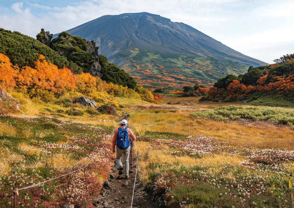
The japan esim mountain and esim rural japan questions are most relevant in Hokkaido, and deserve honest treatment.
Daisetsuzan National Park
Japan’s largest national park covers an area larger than some small countries and contains terrain that genuinely challenges any carrier’s coverage infrastructure. The main tourism corridors — Sounkyo Gorge, the Asahidake ropeway area, Shirogane Onsen — have Docomo coverage that supports navigation and messaging. The park’s interior wilderness, accessible only by trail, moves beyond reliable coverage entirely — a reality that backcountry hikers should plan for with downloaded offline maps and a conservative approach to dependency on digital navigation.
Shiretoko National Park
The Shiretoko Peninsula — a UNESCO World Heritage Site at Hokkaido’s northeastern tip — represents Hokkaido’s most remote major tourist destination. The main visitor areas around Utoro and the Shiretoko Five Lakes have Docomo coverage; the coastal road beyond the main visitor zone and the Shiretoko Pass road through the peninsula’s interior have variable coverage that worsens with distance from population centers.
The Shiretoko visitor who downloads offline Google Maps tiles for the entire peninsula before departing Sapporo or Kushiro is significantly better prepared than one relying on real-time map data throughout the visit.
Hokkaido’s Agricultural Interior
The broad agricultural plains of Tokachi, Kamikawa, and other inland Hokkaido regions — traversed on road trips that are among the most scenically rewarding drives in Japan — have coverage along main national and prefectural routes but can be absent on smaller rural roads between farming communities. Docomo provides the most extensive coverage across these agricultural landscapes, but travelers driving genuinely off-route should anticipate coverage gaps regardless of carrier.
Data Usage on Hokkaido Road Trips
The hokkaido road trip esim data consumption pattern differs from urban Japan touring in specific ways that affect plan sizing.
Navigation Is Continuous
A Hokkaido road trip involves continuous navigation — not the urban navigation of confirming a train exit or finding a restaurant, but genuine wayfinding across a large geography where wrong turns can add significant distance. Google Maps running continuously for eight hours of driving consumes meaningful data. The offline map tile download for all of Hokkaido — done over hotel WiFi before the road trip segment begins — is essential preparation that reduces this data dependency significantly.
Photography and Sharing Spikes
Hokkaido’s scenery generates photography in volumes that other Japan destinations don’t — the morning sea of clouds over Daisetsuzan, the blue pond’s impossible color, a fox crossing a snow-covered road in Shiretoko. Each photo sharing moment represents a data consumption event, and the aggregated sharing over a Hokkaido photography road trip adds up. Plan sizing for a Hokkaido road trip should account for this photographic data demand alongside navigation.
Japan Winter eSIM Considerations
japan winter esim use in Hokkaido has specific practical considerations. Cold temperatures reduce phone battery performance — a phone that lasts twelve hours in Tokyo may last eight in Niseko winter conditions. Carrying a battery pack is more essential in winter Hokkaido than in other Japan contexts. On-slope photography (GoPro transfers, social sharing at the mountain restaurant) adds data consumption that is concentrated in the après-ski period when connectivity is fully restored after a mountain day.
Choosing the Right Japan Sim Data Plan for Hokkaido
For Hokkaido-bound travelers, Japan Sim Data’s plan recommendation is consistent: Docomo network, data allocation sized to your itinerary’s intensity.
For City-Focused Hokkaido Visitors
Travelers spending their Hokkaido time primarily in Sapporo with day trips to Otaru, Hakodate, or the main tourist sites can use any network with confidence. A standard fixed-data plan (10–15GB for a seven-to-ten day trip) covers city navigation, restaurant discovery, and moderate social sharing without requiring unlimited data.
For Niseko and Ski Resort Travelers
esim ski resort japan visitors to Niseko, Furano, or Rusutsu should specify Docomo-network plans and size toward unlimited or large fixed data (20GB+) for the combination of navigation, snow condition apps, on-mountain safety communication, and après-ski social sharing that characterizes a Japan ski resort stay.
For Hokkaido Road Trippers
The hokkaido road trip esim recommendation is Docomo unlimited — the combination of continuous navigation across variable coverage terrain, photography-driven social sharing, and the uncertain duration of data-consuming moments on a flexible itinerary makes unlimited the right call for road trip coverage confidence.
For National Park and Wilderness Visitors
hokkaido tourist sim for visitors concentrating on Daisetsuzan, Shiretoko, or Hokkaido’s wilder areas should specify Docomo, download offline maps before leaving cellular coverage, and plan for the reality that some beautiful places in Hokkaido are, appropriately, beyond the reach of mobile networks.
According to the Japan National Tourism Organization (JNTO), Hokkaido consistently ranks among Japan’s most visited regions for international travelers, with snow tourism, nature tourism, and food culture cited as primary motivators. The GSMA notes that eSIM adoption among travelers to nature-focused and outdoor destinations is growing rapidly, with coverage reliability identified as the primary selection criterion in these contexts.
Conclusion: Match Your Plan to Hokkaido’s Geography

Hokkaido’s extraordinary character — the mountains, the national parks, the road trip landscapes, the ski terrain, the rural agricultural beauty — is precisely the reason connectivity planning here requires more thought than a standard Japan urban tour. The esim hokkaido japan decision that delivers reliable connectivity across this geography is clear: Docomo-network eSIM from Japan Sim Data, with data allocation matched to your itinerary’s intensity.
For Sapporo and the city circuit, any network performs well. For Niseko, Furano, Daisetsuzan, Shiretoko, and the Hokkaido road trip that takes you between and beyond these destinations, Docomo’s coverage breadth is the foundation that makes connectivity reliable where it matters most — not just in the cities, but in the wild, expansive, snow-covered, flower-covered, wildlife-rich Hokkaido that travelers come from around the world to experience.
Japan Sim Data’s Docomo-network eSIM plans for Hokkaido are available at wordpress-1493298-6069223.cloudwaysapps.com — install before departure, activate on landing at New Chitose, and navigate Hokkaido’s extraordinary geography with confidence.
Frequently Asked Questions
Q1: Which carrier has the best coverage in Hokkaido for rural areas and national parks?
A: Docomo provides the most comprehensive coverage across Hokkaido’s rural areas, mountain terrain, and national park corridors — significantly outperforming SoftBank and KDDI in the less-populated areas that define Hokkaido’s character. For any Hokkaido itinerary extending beyond the major city centers, Docomo is the network recommendation.
Q2: Does my eSIM work on the ski slopes at Niseko and Furano?
A: Docomo provides coverage on the main lift corridors and base areas at Niseko and Furano. Upper mountain terrain and backcountry areas have more variable coverage — functional for messaging and basic navigation but potentially limited for bandwidth-intensive use. On-slope coverage for safety communication and snow condition apps works reliably in the main resort zones on Docomo.
Q3: How much data do I need for a ten-day Hokkaido road trip?
A: Hokkaido road trips are data-intensive compared to urban Japan touring — continuous navigation, photography sharing, and communication across variable coverage terrain means daily data consumption of 3–5GB on active driving days. For a ten-day road trip, unlimited or a 30GB+ plan eliminates data management anxiety. Download offline maps for all Hokkaido regions before leaving Sapporo to reduce the navigation data load.
Q4: Is there mobile coverage at Shiretoko National Park?
A: The main visitor areas of Shiretoko — around Utoro, the Shiretoko Five Lakes, and the Kamuiwakka waterfall approach — have Docomo coverage adequate for navigation and messaging. The peninsula’s interior and the coastal road beyond the main visitor zone have progressively weaker coverage. Download offline maps for the entire peninsula before departure and plan for the remote areas to be genuinely offline.
Q5: Can I buy a Hokkaido-specific eSIM, or is a Japan-wide plan necessary?
A: Japan eSIM plans are Japan-wide — there are no Hokkaido-specific products. Japan Sim Data’s Docomo-network plans provide coverage across all of Japan, including Hokkaido’s full geography. A Japan-wide Docomo plan purchased before departure gives you the coverage that Hokkaido’s varied landscape requires, alongside coverage for any other Japan regions you visit before or after Hokkaido.