

Tohoku eSIM Guide: Connectivity for Sendai, Aomori, and Rural North Japan

Tohoku is Japan’s quiet revelation. Where Kyoto offers cultural density and Hokkaido offers northern wilderness, Tohoku — the six-prefecture region of northern Honshu stretching from Fukushima to Aomori — offers something rarer: a Japan that feels genuinely unhurried, where castle ruins stand above river valleys without the crowd infrastructure of more famous destinations, where festivals retain a ritual intensity that tourist-facing culture often loses, and where the combination of dramatic coast, mountain onsen, and deep cedar forest creates an environment unlike anywhere else in the country.
The tohoku esim question is emerging as an increasingly relevant connectivity planning topic as Tohoku’s international visitor numbers grow — partly driven by the recovery narrative following the 2011 Tōhoku earthquake and tsunami, partly by the Shinkansen connectivity that makes Tohoku more accessible than many travelers expect, and partly by the simple discovery that Japan’s northeast is extraordinarily beautiful and authentically engaging in ways that the standard circuit doesn’t provide.
Connectivity in Tohoku requires specific planning because Tohoku’s character is inseparable from its rurality. The destinations that make Tohoku memorable — Yamadera’s clifftop temple above the Yamagata valley, the Shirakami-Sanchi beech forest UNESCO wilderness, Aomori’s Osorezan volcanic crater lake, the Tono folk tale valley in Iwate — are destinations where network coverage reflects the population density: present in the approach towns, variable in the mountain and forest interior, and genuinely absent in the most remote sections.
Why Tohoku Is Japan’s Rising Travel Frontier
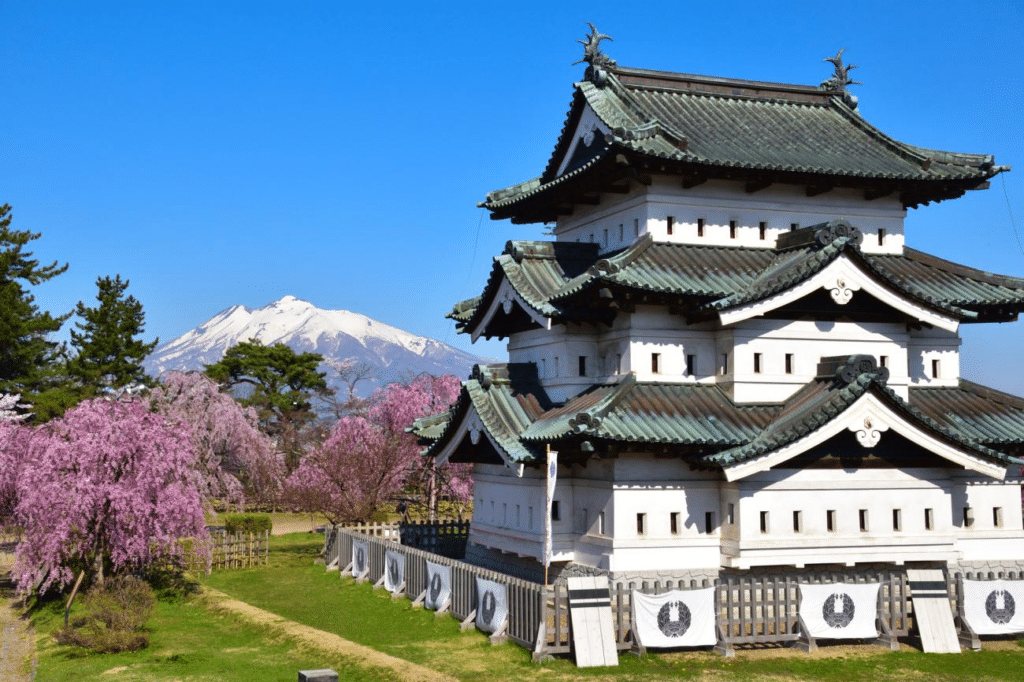
Tohoku’s emergence as an international travel destination has been steady rather than sudden. The Tohoku Shinkansen connecting Tokyo to Shin-Aomori in under three hours placed the entire region within day-trip or overnight-trip range of Tokyo. The development of the Tohoku Expressway and regional airport connections has made road trip access progressively more convenient. And the region’s tourism board’s sustained promotion of Tohoku’s festival culture — the Nebuta Festival in Aomori, the Tanabata Festival in Sendai, the Kanto Festival in Akita — has brought Tohoku’s summer festival season to international awareness.
The japan esim northeast traveler is typically a repeat Japan visitor seeking depth beyond the standard circuit, or a traveler with specific interests in traditional Japanese culture, outdoor experience, or the kind of unmediated encounter with Japanese rural life that urbanized tourism increasingly struggles to provide.
Mobile Coverage Patterns Across Tohoku’s Six Prefectures
Tohoku’s coverage pattern follows the consistent logic of Japan’s network infrastructure: comprehensive in cities and along Shinkansen corridors, progressively thinner in the mountains, forests, and coastal areas that define the region’s character.
Miyagi Prefecture (Sendai Area)
Miyagi is Tohoku’s most populous and most connected prefecture, with Sendai providing an urban connectivity baseline equivalent to Japan’s mid-sized cities. Coverage across the Sendai metropolitan area and the Matsushima Bay coast (one of Japan’s three views) is strong across all three carriers.
The Oshika Peninsula — extending into the Pacific and strongly associated with the 2011 tsunami impact and subsequent recovery — has coverage in the main coastal towns with progressively limited connectivity at the peninsula’s tip.
Iwate Prefecture (Morioka, Hiraizumi, Tono)
Iwate is Japan’s second-largest prefecture by area and has a coverage profile that reflects its vast rural geography. morioka esim connectivity in the prefectural capital is well-supported across all carriers. The Hiraizumi World Heritage temples — Chūson-ji and Mōtsu-ji — are accessed from a small town with adequate Docomo coverage.
The Tono Valley — the folklore heartland of Japan, associated with Yanagita Kunio’s foundational collection of Japanese folk tales — sits in an agricultural valley where Docomo coverage is present but where the surrounding mountain areas transition to variable coverage as you move away from the valley floor.
Aomori Prefecture
Aomori prefecture contains some of Tohoku’s most celebrated destinations and some of its most remote connectivity environments. aomori mobile data in the prefectural capital is well-supported. The Nebuta Festival in Aomori city — one of Japan’s most visually spectacular summer festivals — draws enormous crowds to a well-covered urban environment.
The Shirakami-Sanchi UNESCO beech forest world heritage area along the Aomori-Akita border is genuinely remote — hiking in the old-growth beech forest interior should be treated as an offline experience. The Towada Lake volcanic caldera area and the Hakkoda Mountains have Docomo coverage in the main visitor areas with progressive thinning in the backcountry.
Osorezan — the volcanic crater lake that is one of Japan’s most atmospheric religious sites, associated with the boundary between the living and the dead — has limited but present Docomo coverage in the temple compound area.
Akita Prefecture
akita internet connectivity in Akita City is adequate across all carriers. The Tazawako Lake area — Japan’s deepest lake, set in mountain scenery of extraordinary clarity — has coverage at the lake shore and resort areas. The approach roads through the Akita and Iwate mountains transition through variable coverage terrain where Docomo is the most reliable carrier.
The Nyūtō Onsen hot spring cluster in the mountains above Tazawako is one of Tohoku’s most celebrated onsen destinations — a collection of remote ryokan in a forested valley. Coverage here is Docomo-dependent and limited but present in the main ryokan area.
Yamagata Prefecture
yamagata connectivity is supported well in Yamagata city and along the Ou Main Line corridor. Yamadera temple — the clifftop complex immortalized in Matsuo Bashō’s haiku and one of Tohoku’s most visited cultural sites — has coverage in the approach village and partial coverage on the temple stairway ascent. The Zao Onsen ski resort area has Docomo coverage in the resort base and adequate coverage on the main ski terrain.
The Mogami River gorge and the Dewa Sanzan (Three Mountains of Dewa) sacred mountain complex — a pilgrimage destination of deep significance in Japanese mountain religion — have coverage in the approach towns with variable coverage in the mountain shrine areas.
Fukushima Prefecture
fukushima esim planning covers the southernmost Tohoku prefecture and Japan’s third-largest prefecture by area. Fukushima city and Aizuwakamatsu (the historical castle town) have strong coverage across all carriers. The Urabandai plateau area — a volcanic highland of vivid-colored lakes and marshes — has coverage in the main visitor areas with variable coverage in the wider plateau. The Bandai-Asahi National Park interior has Docomo coverage along main visitor roads with progressive thinning in the backcountry.
City eSIM Tips for Tohoku’s Major Centers
Sendai eSIM
sendai esim requirements reflect a city that is simultaneously Tohoku’s cultural capital, its largest city, and a major transit hub for regional exploration. Coverage in central Sendai — the Ichibancho shopping district, the Sendai Castle ruins, the Osaki Hachimangu shrine — is comprehensive across all carriers.
For travelers using Sendai as a base for regional day trips — to Matsushima by JR Senseki Line, to Yamadera by Yamagata Shinkansen, to the Shichigahama coast — Docomo provides the most consistent connectivity during the transit and destination portions of these excursions.
Morioka eSIM
Morioka’s compact, walkable city center — centered on the Kitakami River confluence, the restored Morioka castle ruins, and a preserved Meiji-era commercial district — has strong coverage across all three carriers. The iron district around Nanbu Tekki ironwork studios and the wanko soba restaurant district are all within well-covered urban zones.
Morioka’s role as the Shinkansen junction for both Akita and Hakodate lines makes it a natural staging point for wider Tohoku exploration — and the northern Tohoku destinations accessed from Morioka reinforce the Docomo recommendation for the next segments of those itineraries.
Akita City
Akita city’s coverage is well-developed for its scale. The Senshu Park castle area, Kanto Matsuri festival grounds, and the entertainment district around the train station all have adequate coverage across all carriers. The museum of art and the nightlife areas are within consistent coverage zones.
Aomori City
Aomori city’s coverage supports the visitor experiences that anchor most international visits: the AOMORI Museum of Art (holding Yoshitomo Nara’s iconic installations), the Nebuta Museum Wa-Rasse, and the Auga morning market near the port. All are within comprehensive coverage zones.
Rural Areas, Festivals, and Remote Hot Springs

Festival Connectivity
The japan esim festival context in Tohoku is distinctive because the major Tohoku festivals — Nebuta in Aomori, Tanabata in Sendai, Kanto in Akita — take place in urban environments during summer evenings when networks are under the highest crowd-generated congestion.
The practical festival connectivity experience is similar to Kyoto’s sakura season at peak sites: functional for messaging and navigation, potentially slower for high-quality photo and video uploading during the peak parade or performance moments. Managing social media sharing to off-peak hours (before the festival crowds gather in the evening, or from accommodation after the event) optimizes the upload experience.
Tohoku Onsen Internet
tohoku onsen internet planning covers a region with extraordinary hot spring heritage. From Nyūtō Onsen in Akita’s mountains to Ginzan Onsen in Yamagata’s silver mine valley (one of Japan’s most photographed onsen towns, particularly magical under winter snow), to the Zao and Hakkoda areas — Tohoku’s onsen destinations range from semi-urban resort towns with adequate connectivity to remote mountain ryokan where mobile coverage is limited.
The pattern is consistent: Docomo provides coverage in the onsen town access areas and along the main approach roads, with connectivity thinning as you move into the mountain core. Ginzan Onsen’s valley setting has Docomo coverage in the main village area — the connection that enables the traveler to share the extraordinary illuminated evening snowscape that has made Ginzan one of Japan’s most shared winter photography subjects.
Shirakami-Sanchi and Remote Wilderness
The Shirakami-Sanchi UNESCO World Heritage beech forest covers the Aomori-Akita border range and represents Tohoku’s most remote accessible wilderness. The main visitor entry points (Anmon Falls on the Aomori side, the Nihon Canyon on the Akita side) have limited Docomo coverage in the car park and approach areas. The hiking trails into the old-growth beech forest interior should be treated as fully offline — download detailed offline maps for the entire area before departure from the nearest town.
Best Carrier Choice for Tohoku Travel
The docomo tohoku recommendation is the consistent conclusion for any Tohoku itinerary that ventures into the region’s rural, mountain, or wilderness character — which is to say, any Tohoku itinerary worth making.
softbank tohoku and kddi tohoku provide adequate coverage in Tohoku’s urban centers and along the main transit corridors. The differentiation from Docomo appears in rural Tohoku in the same way it appears in rural Hokkaido — progressively, as the itinerary moves away from population centers and into the mountain, forest, and coastal environments that define Tohoku’s appeal.
For a tohoku tourist sim or esim for tohoku that covers both the urban cultural highlights and the rural natural destinations, Docomo is the network that provides continuity across the full geographic range of a meaningful Tohoku itinerary.
Japan Sim Data Recommendations for Tohoku Trips
For the City and Culture Circuit
Travelers covering Sendai, Matsushima, Hiraizumi, Morioka, and Aomori — primarily by Shinkansen and train, with cultural and historic site visits — can use any Japan Sim Data network on a standard fixed-data plan (10–15GB for a seven-to-ten day trip). The northern japan esim for this itinerary type covers urban navigation, cultural site research, and moderate social sharing without unlimited data.
For the Rural and Nature Explorer
The Tohoku traveler whose itinerary includes Tono, Nyūtō Onsen, Shirakami-Sanchi, Osorezan, or the Dewa Sanzan should specify Docomo-network plans. The tohoku data plan for rural exploration benefits from sizing toward 20GB or unlimited to account for the navigation-intensive nature of travel through areas with limited road signage and variable coverage terrain.
For Festival Travelers
Festival-focused Tohoku visits centered on Aomori’s Nebuta (early August), Akita’s Kanto (early August), or Sendai’s Tanabata (mid-August) are primarily urban connectivity scenarios. Any network performs adequately, though Docomo provides additional confidence for travel outside the festival city before and after the main event.
For Road Trippers
The mobile data tohoku road trip covering multiple prefectures — the classic Tohoku circuit from Sendai through Yamagata, Fukushima, Aizuwakamatsu, Niigata (if extending the circuit), and north through Akita and Aomori — is best served by Docomo unlimited for consistent connectivity across the full geographic range of Tohoku’s road trip landscape.
According to the Japan National Tourism Organization (JNTO), Tohoku’s international visitor numbers have grown significantly as the region has promoted its natural attractions, festival culture, and cultural heritage to overseas markets. The GSMA notes that Japan’s rural and off-the-beaten-path regions are increasingly significant eSIM use cases, with coverage reliability in less-urbanized environments the primary selection criterion.
Conclusion: Japan’s Northeast Deserves the Right Network

Tohoku’s appeal is inseparable from its character as Japan’s rural north — the temple in the forest, the onsen in the mountain valley, the festival in the coastal city, the folk tale in the agricultural plain. Connectivity planning that accounts for this rurality, rather than assuming Japan’s urban coverage extends uniformly to every corner of its most geographically wild region, is the practical preparation that makes Tohoku exploration smooth rather than stressful.
Docomo for rural and mountain Tohoku destinations. Any carrier for the city circuit. Offline maps downloaded before departing urban centers for wilderness areas. And a data plan sized to match the photographic inspiration that Tohoku’s unsung landscapes consistently provide.
Japan Sim Data’s Docomo-network eSIM plans for Tohoku and northern Japan are available at wordpress-1493298-6069223.cloudwaysapps.com — install before departure and navigate Japan’s most underrated region with the confidence that reliable connectivity provides.
Frequently Asked Questions
Q1: Which carrier has the best coverage for rural Tohoku?
A: Docomo provides the most comprehensive coverage across Tohoku’s rural areas, mountain onsen destinations, national parks, and festival cities. SoftBank and KDDI are adequate in Tohoku’s main cities but have less coverage depth in the rural and wilderness areas that define Tohoku’s character.
Q2: Is there connectivity at Ginzan Onsen in Yamagata?
A: Yes — Ginzan Onsen’s main village area has Docomo coverage that supports messaging and moderate social sharing, including the illuminated winter evening photography that has made Ginzan one of Japan’s most-shared winter images. The surrounding mountain areas have progressively limited coverage.
Q3: Does mobile data work at the Nebuta Festival in Aomori?
A: Yes, though peak festival periods may see congestion-related speed reduction during the most crowded parade moments. All carriers provide functional connectivity in Aomori city during the Nebuta Festival. Docomo provides the most consistent performance; high-quality uploads are best timed for before or after the peak festival crowds.
Q4: Is there coverage in the Shirakami-Sanchi UNESCO beech forest?
A: Limited Docomo coverage exists at the main visitor entry points and car parks. The hiking trails into the old-growth beech forest interior should be treated as offline. Download detailed offline maps for the entire hiking area before departure from the nearest town, and plan the trail experience as connectivity-free.
Q5: What data plan is best for a two-week Tohoku road trip?
A: Docomo unlimited is the recommended specification for a comprehensive Tohoku road trip. Continuous navigation through Tohoku’s varied terrain, photography-driven social sharing of the region’s exceptional scenery, and the coverage variability of rural driving all favor unlimited data on Japan’s most extensive rural network.