

Kansai eSIM: Osaka, Kyoto, Nara, and Kobe Connectivity Guide

Kansai is where most international Japan trips begin in earnest. Tokyo may be the arrival gateway for many visitors, but Kansai — the tightly interconnected region encompassing Osaka, Kyoto, Nara, Kobe, Himeji, and the sacred mountain landscapes of Koyasan and Yoshino — is where Japan’s cultural and sensory depth becomes fully apparent. The region concentrates more UNESCO World Heritage Sites than any equivalent area outside of Italy, more Michelin-starred restaurants than any city outside of Tokyo and Paris, and a street food culture in Osaka’s Dotonbori that has become one of the world’s great culinary neighborhoods. It is, for a reason, the first destination that comes to mind when travelers ask what Japan is really like.
The kansai esim question is among the most favorable connectivity planning exercises in Japan travel — Kansai’s combination of urban density, tourism infrastructure investment, and the concentrated visitor numbers that have driven telecommunications development means that connectivity across the main Kansai circuit is consistently excellent. The osaka esim, kyoto esim, and nara mobile data questions all resolve positively across all three major carriers. The more interesting connectivity considerations in Kansai emerge in the day trip transitions — to the sacred mountain of Koyasan, the cherry blossom hillside of Yoshino, and the more rural sections of Wakayama and southern Nara where Kansai’s urban connectivity excellence gives way to a more variable rural network environment.
This guide covers the full Kansai connectivity picture with the specificity that helps travelers understand not just that “coverage is good in Kansai” but precisely where it excels, where it occasionally varies, and how to plan data usage across a Kansai itinerary that balances urban tourism with the rural and mountain day trips that give Kansai its full dimension.
Why Kansai Attracts So Many First-Time Visitors

Kansai’s appeal to first-time Japan visitors is structural rather than incidental. The region’s major highlights are close enough together that a week-long Kansai base allows visitors to experience Osaka’s food culture, Kyoto’s temple heritage, Nara’s deer park and Todai-ji, and Kobe’s harbor district without the complexity of multiple accommodation changes. The Kansai Thru Pass and JR Kansai Area Pass make transit between cities efficient and affordable. And the sheer concentration of world-class experiences within the region — from Fushimi Inari’s torii gates to Arashiyama’s bamboo grove to Osaka Castle to the view of Himeji from the castle approach road — means that a Kansai-focused itinerary rarely leaves travelers feeling they’ve missed the essential Japan.
The japan esim west connectivity that supports this visitor density has been correspondingly developed — Kansai’s telecommunications infrastructure reflects both the region’s own economic weight and the enormous volume of international visitors who need data access from the moment they arrive at Kansai International Airport.
Mobile Coverage Across Kansai’s Major Destinations
Osaka eSIM
osaka esim connectivity is as strong as any destination in Japan. Osaka’s urban density — from the Shinsaibashi shopping corridor to the Dotonbori canal district, from Namba to Umeda and the Osaka Business Park area — is blanketed with comprehensive coverage across all three carriers. Osaka Castle Park’s open grounds provide strong signal across all networks; the castle interior and surrounding museum areas are within full urban coverage.
Underground in Osaka’s extensive subway and shopping mall network — the Namba shopping basement complex, the underground links between Umeda stations — coverage is generally maintained, though occasional dead zones exist in specific basement and tunnel sections.
For the kansai tourist sim question in an Osaka context, any Japan Sim Data network performs with equal excellence. SoftBank’s historically strong relationship with Osaka’s commercial districts provides excellent urban performance; Docomo and KDDI are equally capable in the Osaka urban environment.
Kyoto eSIM
esim for kyoto requirements cover the full range of Kyoto’s visitor experience — from the most visited sites (Kinkaku-ji, Fushimi Inari, Arashiyama, Nijo Castle) to the quieter temple circuits of the eastern Higashiyama ward and the northern Kinkaku-ji/Ryōan-ji/Kinkaku-ji triangle.
Coverage across Kyoto’s main tourist sites is consistent across all three carriers:
Fushimi Inari Taisha: Strong coverage at the base and lower trail. Coverage becomes more variable in the upper mountain sections above the mid-trail teahouses; Docomo is most reliable throughout the full ascent.
Arashiyama: Strong coverage in the bamboo grove approach, Tenryu-ji garden, and the main Togetsukyo bridge area. The Saga-Arashiyama district’s residential lanes have adequate coverage.
Higashiyama: The Sannen-zaka and Ninen-zaka preserved townscape approach to Kiyomizu-dera is well-covered across all carriers. The Kiyomizu-dera main hall and stage area, Maruyama Park, and the Heian Shrine compound are all within comprehensive coverage zones.
Northern Kyoto (Kurama, Kibune): The narrow mountain valley settlements of Kurama and Kibune — accessible by the Eizan Railway — have adequate Docomo coverage in the village areas with more limited connectivity on the hiking trail between the two valleys.
Nara Mobile Data
nara mobile data requirements for the primary visitor sites — Nara Park, Todai-ji Great Buddha Hall, Kasuga Taisha, the Isuien and Yoshikien gardens — are well-supported across all carriers. The open Nara Park setting provides excellent signal propagation that makes Nara one of the most consistently covered outdoor temple sites in Japan.
The transition from Nara city connectivity to rural southern Nara — for travelers extending their visit toward Asuka’s archaeological sites, the Yoshino mountain pilgrimage, or the Yoshino Cedar forest UNESCO approaches — introduces the coverage variability discussed in the day trip section below.
Kobe Internet
kobe internet connectivity in the main tourist areas — the Kitano-cho foreign settlement district, Kobe Harborland waterfront, the Shin-Kobe Ropeway approach and Nunobiki Herb Garden summit, and the Nada sake brewery district — is well-supported across all carriers. Kobe’s compact tourism geography makes coverage planning straightforward.
The Arima Onsen hot spring resort town in the Rokko mountains behind Kobe — accessible by the Kitashinchi subway and Shintetsu Arima Line — has adequate Docomo coverage in the main onsen town with some signal variability on the mountain approach road sections.
Himeji eSIM
himeji esim requirements center on the castle — Japan’s most celebrated and most photographed — and its surrounding garden and cultural sites. Coverage in central Himeji and throughout the castle approach is strong across all carriers. The castle’s elevated position actually improves signal propagation in the upper courtyard areas compared to street level.
eSIM Tips for Temple Hopping and Shrine Visits
Indoor Signal at Major Temples
The japan esim temple connectivity note that applies across Kansai’s major enclosed religious structures — Todai-ji’s Great Buddha Hall, Nijo Castle’s main palace interior, Osaka Castle’s donjon museum — is that thick historical walls can reduce signal penetration. This is typically a brief and minor reduction in signal quality rather than a complete coverage absence, and messaging and translation functions generally remain operational.
The outdoor shrine and garden environments — Fushimi Inari’s torii gate corridors, Kasuga Taisha’s approach lantern-lined path, Kinkaku-ji’s garden — have signal propagation unrestricted by structural barriers and typically excellent connectivity.
Peak Season Congestion Management
Kansai’s major sites during peak season — Golden Week in late April/early May, August summer holidays, sakura season in late March/early April, and autumn foliage season in November — see visitor concentrations that can create network congestion at specific sites during peak midday hours.
The practical management approach mirrors advice for other high-traffic Japanese destinations: high-quality photo and video uploads are best timed for morning visits before the largest crowds arrive, or for evening return to accommodation with hotel WiFi. Navigation and messaging function reliably even during peak congestion.
Data Usage on the Kansai Thru Pass and City Subways
The kansai thru pass internet use case represents one of the more pleasant connectivity experiences in Japan travel — the Kansai Thru Pass covers private railways, subways, and buses across the region, and the transit journey between Kansai cities provides excellent mobile coverage throughout.
The Hankyu and Kintetsu private railway lines connecting Osaka, Kyoto, and Nara maintain coverage throughout their urban and suburban sections. The Osaka Metro subway system maintains signal on most lines, with occasional brief signal drops in deep tunnel sections. The Kobe City Subway and Port Liner to Kobe Airport both maintain adequate coverage for transit use.
The transit data use case in Kansai is primarily navigation (confirming the right exit or platform), real-time train timing updates, and occasional messaging — all light data consumption functions that any Japan Sim Data plan handles comfortably.
Day Trips to Koyasan, Yoshino, and Wakayama
Koyasan (Mount Koya)
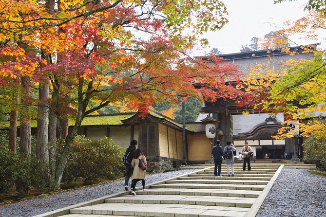
Koyasan is one of Japan’s most extraordinary spiritual destinations — the sacred mountain temple complex founded by Kūkai (Kōbō Daishi) in the 9th century, where visitors can stay in temple lodgings (shukubo), participate in morning prayer ceremonies, and walk the cypress-shadowed Ōkunoin graveyard approach at dusk. It is also one of the day trips from the main Kansai circuit where connectivity planning requires specific attention.
The approach to Koyasan — by the Nankai Koya Line to Gokurakubashi and then the cable car to the summit — passes through mountain terrain where coverage becomes limited. On the Koyasan plateau itself, Docomo provides coverage in the main temple complex areas and along the Ōkunoin approach path. SoftBank and KDDI coverage on Koyasan is less comprehensive, with some areas of the temple town having limited signal.
The mobile data kansai japan day trip recommendation for Koyasan: download offline maps for the entire Koyasan area before departing Osaka or Nanjing, and specify Docomo for the most reliable on-mountain connectivity.
Yoshino (Mount Yoshino)
Yoshino’s famous cherry blossom hillside — covered in over 30,000 trees that bloom in successive waves from the lower to upper mountain from late March through early April — is one of Japan’s most celebrated sakura experiences. The Yoshino area is accessed from Kintetsu Yoshino Line, and coverage in the main Yoshino Jingu area and lower town is adequate on Docomo.
The upper Yoshino areas — Okusengoku and Miyoshi — become more coverage-limited as the mountain path extends into the pilgrimage route toward Omine mountain. The kansai itinerary esim recommendation for Yoshino during peak sakura: download offline maps, expect network congestion at peak bloom periods similar to Kyoto’s sakura sites, and carry portable battery backup for a full mountain day.
Wakayama and the Kumano Kodo
The Kumano Kodo pilgrimage network in Wakayama Prefecture — connecting the three Grand Shrines of Kumano through ancient forest trail — is Kansai’s most remote day trip or multi-day extension destination. The main Kumano towns (Shingu, Hongu, Nachisankei) have adequate Docomo coverage. The forest trail sections of the pilgrimage route — particularly the Nakahechi (Imperial Route) through the Kii Mountains — have very limited coverage in the forest interior.
The Kumano Kodo hiker’s connectivity recommendation: Docomo, offline maps downloaded for the full trail route, and the realistic expectation that the most beautiful and remote forest sections will be offline.
Best Japan Sim Data Plans for Kansai Itineraries
For the Standard Kansai City Circuit
The core Kansai city circuit — Osaka, Kyoto, Nara, Kobe, Himeji — is served excellently by any Japan Sim Data network. A standard fixed-data plan (10–15GB for a seven-to-ten day trip) covers urban navigation, temple and shrine research, restaurant discovery (Tabelog for Osaka’s extraordinary food scene requires data), and moderate social sharing. The kansai data plan for this itinerary type is the most straightforward connectivity decision in this guide series.
For Kansai Plus Rural Day Trips
Travelers adding Koyasan, Yoshino, or the Kumano Kodo to a Kansai base itinerary should specify Docomo for the rural coverage advantage on these mountain and forest destinations. Data sizing can remain at 10–15GB for a combined urban-rural itinerary, though travelers planning extensive Kumano hiking should consider 15–20GB for the combination of urban photography sharing and rural navigation.
For Extended Kansai Stays
Travelers spending two weeks or more in the Kansai region — exploring beyond the main circuit to southern Kyoto, the Nara basin’s smaller temples, Osaka’s neighborhood izakaya culture, and the rural Kii Peninsula — benefit from a larger plan (20GB or unlimited) that covers the extended data consumption of a long Japan stay without plan management concerns.
According to the Japan National Tourism Organization (JNTO), the Kansai region receives the highest volume of international visitor overnight stays of any Japan region, with Osaka and Kyoto consistently among Japan’s top three international visitor cities. The GSMA notes that urban Japan eSIM adoption has reached significant penetration among international visitors, with Kansai identified as one of Japan’s highest eSIM adoption destinations.
Conclusion: Kansai’s Connectivity Matches Its Tourism Excellence
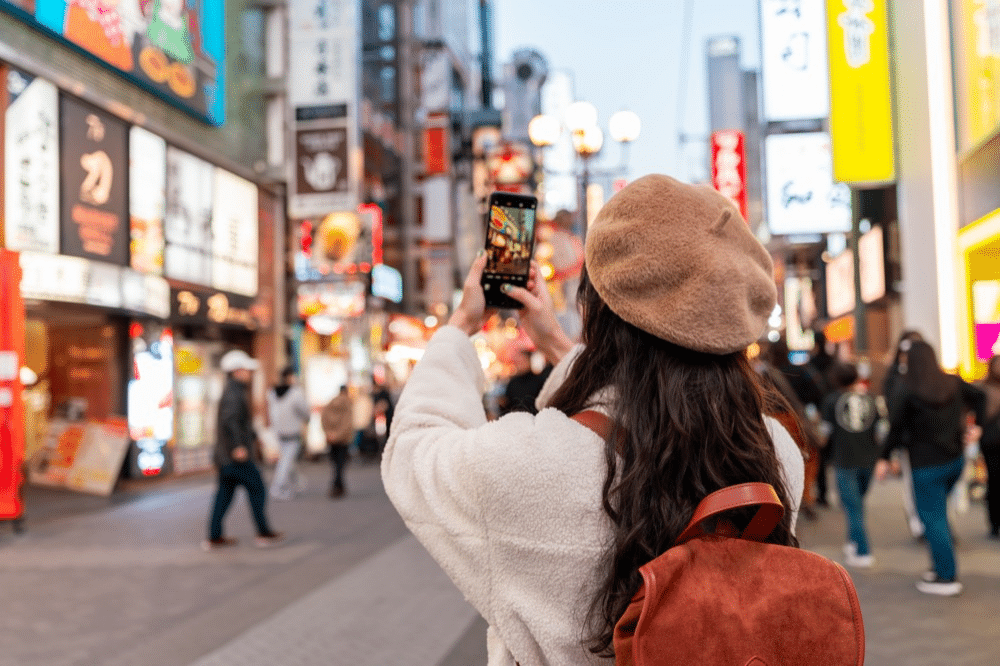
The kansai connectivity assessment is as positive as any Japan region’s connectivity picture: comprehensive across all three carriers in the major cities, excellent for transit use, strong at the region’s most celebrated temples and shrines, and Docomo-reliable for the rural and mountain day trips that give a Kansai itinerary its full dimension.
For the vast majority of Kansai travelers, the Japan Sim Data plan decision is primarily about data volume rather than network selection — any carrier performs well across the main Kansai circuit, and the choice of 10GB versus 20GB versus unlimited is determined by how extensively you plan to photograph, share, and consume content during your visit to Japan’s cultural heartland.
For travelers adding Koyasan, Yoshino, or the Kumano Kodo: specify Docomo. For everyone else in Kansai: choose your plan with confidence, install it before departure from home, activate on landing at Kansai International or Shin-Osaka, and enjoy one of the world’s great travel regions with connectivity that works exactly as it should.
Japan Sim Data’s eSIM plans for Kansai are available at wordpress-1493298-6069223.cloudwaysapps.com.
Frequently Asked Questions
Q1: Which carrier is best for the Osaka-Kyoto-Nara-Kobe circuit?
A: All three carriers — Docomo, SoftBank, and KDDI — perform excellently across the main Kansai city circuit. There is no meaningful coverage differentiation between them for urban Kansai tourism. The carrier selection decision becomes relevant when day trips extend to Koyasan, Yoshino, or Kumano, where Docomo’s rural coverage advantage is operationally significant.
Q2: Is there connectivity at Fushimi Inari’s upper mountain trail?
A: The lower Fushimi Inari trail is well-covered across all carriers. Coverage becomes more variable above the mid-trail teahouse area in the upper mountain section. Docomo provides the most consistent coverage across the full trail ascent to the summit, making it the recommended carrier for visitors planning the complete Inari mountain hike.
Q3: How much data does a typical seven-day Kansai trip consume?
A: A Kansai visitor using navigation between sites, translating temple information boards and menus, moderate social media sharing, and daily messaging typically uses 1–2GB per day — 7–14GB for a standard week-long trip. A 10GB plan covers light-to-moderate users; 15GB provides comfortable headroom for more active social sharers and photographers.
Q4: Does the Kansai Thru Pass work well with eSIM for transit navigation?
A: Yes. The Kansai Thru Pass routes and transit options are well-supported by Google Maps and Navitime for Japan, both of which run effectively over any Japan eSIM. Transit coverage on the Hankyu, Kintetsu, and Osaka Metro lines is maintained throughout most journeys, supporting real-time routing and station navigation.
Q5: Is Koyasan coverage reliable enough for navigation during a day trip?
A: Docomo provides coverage in the main Koyasan temple complex, the Ōkunoin graveyard approach, and the Kongobuji area. For reliable navigation throughout the Koyasan visit, download offline maps for the entire Koyasan area before departing Osaka — this provides navigation confidence regardless of real-time coverage availability in specific areas.