

Chubu and Japan Alps eSIM: Nagano, Takayama, Kanazawa Connectivity Guide
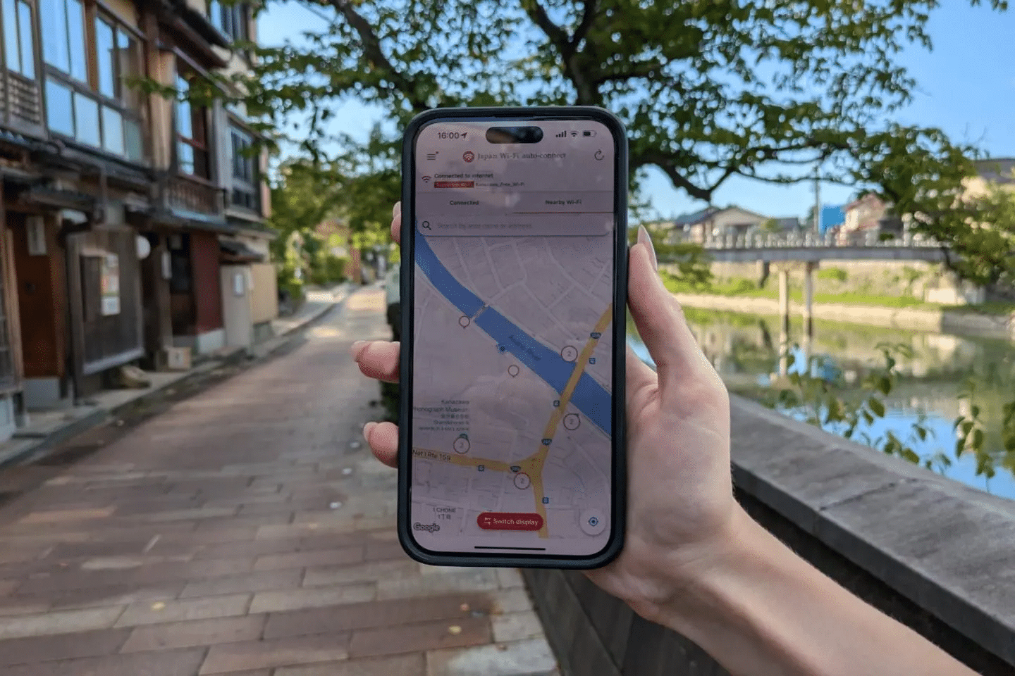
Central Japan’s Chubu region offers one of the country’s most geographically dramatic travel corridors — the Japan Alps, three parallel mountain ranges running north to south through Nagano, Gifu, and Toyama prefectures, creating a landscape of 3,000-meter peaks, deep valleys, traditional alpine villages, and the kind of outdoor environment that draws hikers, skiers, and landscape photographers from around the world. Framing this alpine core are cities of considerable cultural and culinary weight: Nagoya as Chubu’s industrial and commercial capital; Kanazawa as Japan’s most complete castle town outside Kyoto; Matsumoto with its original feudal castle and gateway to the Kamikochi highland; Takayama as Japan’s best-preserved mountain town with sake breweries and morning markets unchanged for centuries.
The japan alps esim question is one of the more technically interesting connectivity planning challenges in Japan travel, because the region spans an extraordinary range of connectivity environments — from Nagoya’s world-class urban network to the Tateyama-Kurobe Alpine Route’s 3,000-meter mountain traversal, from Kanazawa’s historic townscape to the genuine wilderness of Kamikochi’s protected valley.
This guide covers the full Chubu and Japan Alps connectivity picture: mountain coverage realities, city-by-city eSIM tips across the region’s major destinations, specific guidance for the Alpine Route, Kamikochi, Hakuba, and other mountain destinations, and Japan Sim Data plan recommendations for the full range of Chubu itinerary types.
The Appeal of Chubu and the Japan Alps
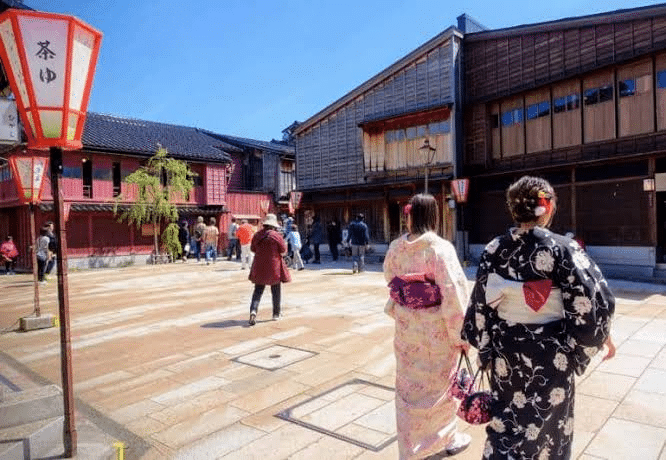
Chubu’s travel appeal spans multiple traveler archetypes. The cultural traveler finds in Kanazawa a city that rivals Kyoto for preserved heritage — the Kenroku-en garden, the Higashi Chaya geisha district, the 21st Century Museum of Contemporary Art, and the Omicho fish market represent a cultural density that few Japanese cities outside the main circuit can match. The outdoor traveler finds in the Japan Alps one of Asia’s premier alpine environments — the Kita Alps (Northern Alps), the Chuo Alps (Central Alps), and the Minami Alps (Southern Alps) providing hiking, climbing, and skiing terrain that has earned Japan the title of “the Japan Alps” precisely because the comparison to Switzerland is apt.
The winter sports traveler finds Hakuba as Japan’s premier international ski destination outside Hokkaido — a valley of linked resorts that hosted the 1998 Nagano Olympics and attracts significant international skiing clientele particularly from Australia and Southeast Asia. And the road tripper finds in the Hida Folk Village road and the approach to Takayama through the Hida Valley one of Japan’s most scenic mountain drives.
Mobile Network Coverage in Mountain Regions
The Alpine Coverage Reality
mountain coverage in the Japan Alps follows the same topographic logic as other Japanese mountain regions — towers follow population, and the Japan Alps’ high terrain creates coverage patterns that anyone planning connectivity for mountain activities needs to understand honestly.
The valley floors and town areas in the Japan Alps have coverage ranging from adequate to strong depending on the specific valley and carrier. The alpine environments above the treeline, the high mountain hut approaches, and the technical ridge traversals that mountaineers pursue are genuinely beyond reliable mobile coverage regardless of carrier.
Docomo in the Japan Alps
docomo chubu coverage across the Japan Alps region is the most extensive of the three carriers, reflecting the same national rural and mountain coverage investment that makes Docomo the recommendation for Hokkaido’s backcountry and Tohoku’s remote onsen towns. In the accessible mountain environments — the Tateyama-Kurobe Alpine Route’s main stations, the Kamikochi bus terminal and river walk areas, the Hakuba ski resort base areas — Docomo provides the most consistent connectivity.
SoftBank and KDDI in Chubu
softbank chubu and kddi chubu both provide strong coverage in Chubu’s urban centers (Nagoya, Kanazawa, Matsumoto, Nagano city) and along the main transit corridors. The differentiation from Docomo appears in the mountain and rural environments — the valley floors of the Alps, the approach roads to mountain destinations, and the resort areas beyond the main town infrastructure — where Docomo’s investment provides coverage that the other carriers don’t consistently match.
City eSIM Tips for Chubu’s Major Centers
Nagoya Mobile Data
nagoya mobile data requirements reflect Japan’s fourth-largest city and its comprehensive urban telecommunications infrastructure. Nagoya’s urban coverage is excellent across all three carriers — the Nagoya Station area (one of Japan’s most architecturally spectacular station complexes), Sakae’s entertainment and shopping district, the Nagoya Castle grounds, and the Atsuta Jingu shrine precincts are all within full urban coverage.
Nagoya’s food culture — hitsumabushi (grilled eel with dashi), miso katsu, kishimen flat noodles, and the morning coffee set culture in the city’s vintage Namba-style coffee houses — benefits from Tabelog and Google Maps research that any Japan Sim Data carrier supports in the city environment.
For the chubu tourist sim question in a Nagoya-only context, any Japan Sim Data network performs with equivalent excellence. The carrier selection decision becomes significant when departing Nagoya toward the mountain destinations of Chubu’s interior.
Nagano eSIM
nagano esim planning covers the 1998 Winter Olympics host city and its surrounding cultural and mountain tourism. Nagano city’s coverage — the Zenkoji Temple precinct (one of Japan’s most visited Buddhist temples), the Olympic Museum, and the city’s train station area — is adequate across all carriers.
The more important connectivity consideration for Nagano-based travelers is the mountain and alpine destinations accessible from the city: Hakuba for skiing, Kamikochi for alpine hiking, and Shiga Kogen for linked resort skiing — all of which have their own coverage profiles discussed below.
Matsumoto eSIM
matsumoto esim requirements cover one of Japan’s most atmospheric castle towns — Matsumoto Castle’s original wooden black donjon reflected in the surrounding moat is one of Japan’s most beautiful castle images — and the gateway city for Kamikochi access via the Matsumoto Electric Railway.
Coverage in Matsumoto city and castle area is strong across all carriers. The city’s gallery of Japanese art (the Matsumoto City Museum of Art, known for its Yayoi Kusama installations) and the covered shopping street are within comprehensive coverage zones.
The Matsumoto to Kamikochi transit — by train to Shin-Shimashima station and then bus through the Azusa valley — transitions from urban coverage to mountain valley coverage, with Docomo maintaining the most consistent signal throughout the mountain approach.
Takayama Internet
esim for takayama planning covers one of Japan’s most beloved traditional mountain towns — the Sanmachi Suji sake brewery and merchant house preservation district is the most intact historic commercial streetscape in Japan outside of Kyoto, and Takayama’s morning markets, folk art shops, and Hida beef cuisine create a day’s worth of rich experience within an extraordinarily compact area.
Coverage in Takayama’s historic center is adequate on Docomo and reasonable on other carriers for the urban tourism functions. The approach to Takayama — by limited express from Nagoya through the Hida Valley on the Hida Line, or by the Norikura road from Matsumoto — passes through mountain valley terrain where Docomo provides the most consistent connectivity.
The Hida Folk Village (Hida no Sato) — an open-air museum of relocated traditional farmhouses, gasshō-zukuri thatched structures, that is one of Takayama’s most visited attractions — is within the Takayama urban coverage zone.
Kanazawa eSIM
kanazawa esim requirements cover what is arguably Japan’s most culturally rich city outside the main Tokyo-Kyoto-Osaka triangle. Kenroku-en garden (one of Japan’s three great landscape gardens), the Higashi Chaya geisha district, the D.T. Suzuki Museum (Zen Buddhism), the 21st Century Museum of Contemporary Art, and the extraordinary Omicho fish market — Kanazawa concentrates cultural heritage at a density that rewards extended visits.
Coverage across all three carriers is strong throughout Kanazawa’s compact tourism circuit. The Kanazawa chubu itinerary esim question for city-focused visitors has the same positive answer as the Kansai major city question — any carrier performs excellently in Kanazawa’s urban environment.
Alpine Route, Kamikochi, and Hakuba Coverage

The Tateyama-Kurobe Alpine Route
The Tateyama-Kurobe Alpine Route — running across the Kita Alps between Toyama and Omachi in Nagano — is one of Japan’s most spectacular mountain transit experiences, traversing Japan’s highest road pass through snow corridors that reach 20 meters in height in late April and May. It uses a combination of cable car, trolley bus, ropeway, and alpine road to cross the 3,000-meter Tateyama range.
japan mountain esim coverage on the Alpine Route is Docomo-dependent and limited at the highest elevations. The Murodo plateau at 2,450 meters — the highest accessible point on the route — has limited Docomo coverage that provides messaging and basic navigation. The underground trolley bus sections and enclosed cable car infrastructure are beyond mobile signal regardless of carrier.
The Alpine Route experience is one where connectivity should be expected as a supplement rather than a constant — the experience itself is so visually overwhelming that phone use appropriately takes a back seat, and the key connectivity function is messaging family and friends at the platform stops and visitor stations where Docomo signal is available.
Kamikochi
kamikochi esim planning covers one of Japan’s most spectacular alpine valleys — a flat-floored glacial valley at 1,500 meters, closed to private vehicles, accessible only by bus and taxi from Matsumoto, and offering what is perhaps Japan’s finest sub-alpine landscape walk: the Azusa River from the Kappa-bashi suspension bridge through the Taisho Pond area and toward the towering Hotaka massif.
Coverage in Kamikochi is Docomo-dependent and limited. The Kappa-bashi area and the main valley floor walk has Docomo coverage adequate for messaging and basic photography sharing. The hiking trails ascending toward the higher mountains and passes move beyond reliable coverage quickly.
The practical Kamikochi connectivity approach: download offline maps for the entire valley floor area and approach trail system before departing Matsumoto. The Kamikochi experience rewards attention to the extraordinary landscape — the walk from Kappa-bashi to Myojin Pond is one of Japan’s great mountain walks, and the smartphone’s most important role here is as a photography tool rather than a connectivity device.
Hakuba Connectivity
hakuba connectivity for ski and outdoor travelers follows the coverage pattern established in the ski resort section of this guide — Docomo for the resort base areas, mountain approach roads, and the upper mountain sections where connectivity matters most for ski school coordination, slope condition checking, and safety communication.
The Hakuba valley has five main ski areas — Hakuba Happo-One (the 1998 Olympic venue), Hakuba47/Goryu, Hakuba Norikura, Iwatake, and Cortina — spread across a valley of significant geographic width. Docomo coverage is strongest and most consistent across all resort areas; SoftBank and KDDI provide adequate coverage in the main resort base zones.
For the japan esim ski traveler at Hakuba, the coverage considerations are identical to those described for Niseko and other Japanese ski destinations: Docomo for reliability across the full resort geography including upper mountain terrain.
eSIM Tips for Winter Sports and Summer Hiking
Winter Sports Connectivity
japan alpine esim for winter sports in the Chubu region covers Hakuba, Shiga Kogen, Nozawa Onsen (detailed in the ski connectivity guide), and the smaller Nagano-area resorts developed around the 1998 Olympics infrastructure. For all of these resorts, the Docomo recommendation applies consistently.
Data usage in the winter sports context follows the après-ski pattern established in the ski connectivity discussion: conservative during active skiing when the device is in a jacket pocket and the mountain environment is the focus; intensive in the evening when the day’s photography is uploaded, snow conditions for the following day are checked, and dining reservations are made.
Summer Hiking Connectivity
Summer hiking in the Japan Alps is one of Japan’s great outdoor experiences, with the Kita Alps’ Hotaka range, the Yari-ga-take “spear peak,” and the panoramic ridge walks above Kamikochi drawing serious mountaineers and casual hikers alike. For summer hiking connectivity:
The mountain hut (yamagoya) system in the Japan Alps is extraordinary — these well-staffed high-altitude shelters provide meals, accommodation, weather information, and — increasingly — limited WiFi connectivity in the common areas. The Japan North Alps Huts Association has been expanding WiFi provision, but signal quality varies by hut and weather conditions.
Mobile coverage on the ridgeline hiking routes above 2,500 meters is genuinely limited on all carriers. Download offline maps for all planned hiking routes before departing from valley towns. The hiking GPS apps (Yamap is Japan’s most popular hiking navigation app) allow offline functionality with pre-downloaded trail maps.
Japan Sim Data Plans for Chubu Itineraries
For Urban Chubu (Nagoya, Kanazawa, Matsumoto)
City-concentrated Chubu itineraries are well-served by any Japan Sim Data network on a standard 10–15GB fixed data plan. Urban navigation, cultural site research, Kanazawa’s extraordinary food market exploration, and moderate social sharing are all within comfortable range for this plan size.
For Mountain and Alpine Destinations
The chubu data plan for travelers including Hakuba, Kamikochi, the Tateyama-Kurobe Alpine Route, and mountain hiking should specify Docomo for the rural and alpine coverage advantage. Plan sizing toward 15–20GB accommodates the photography-intensive nature of the Japan Alps experience without unlimited’s premium.
For Winter Sports Travelers
japan esim ski visitors to Hakuba should specify Docomo unlimited — the combination of resort connectivity needs, après-ski social content creation, and the elevated daily data usage that ski resort stays generate makes unlimited the right specification for a Hakuba ski week.
For Comprehensive Chubu Road Trips
The mobile data japan alps road trip covering Nagoya, Takayama (via Hida Valley), Shirakawa-go (the UNESCO gasshō-zukuri village), Kanazawa, and Nagano should specify Docomo for consistent coverage across the mountain passes and rural valley roads that connect these destinations. Unlimited is recommended for the photography demands of one of Japan’s most scenically rewarding road circuits.
According to the Japan National Tourism Organization (JNTO), Kanazawa and the Japan Alps region have become priority international tourism development destinations, with the Hokuriku Shinkansen extension to Tsuruga scheduled to bring further accessibility improvements. The GSMA notes that alpine and mountain tourism eSIM adoption is growing rapidly, with Japan’s mountain destinations among the leading use cases for outdoor travel connectivity planning.
Conclusion: Alpine Japan Rewards Connectivity Preparation

The Japan Alps and Chubu region rewards travelers who approach it with preparation — the offline maps downloaded before the mountain road, the Docomo plan specified for the alpine coverage advantage, the data allowance sized for the extraordinary photography that this landscape inevitably generates. When connectivity preparation matches the geographic range of a Chubu itinerary, the experience of moving between Kanazawa’s cultural riches, Takayama’s traditional mountain town, and Kamikochi’s alpine perfection is seamlessly supported by the connectivity infrastructure that makes modern travel logistics both manageable and enjoyable.
Japan Sim Data’s Docomo-network eSIM plans for Chubu and the Japan Alps are available at wordpress-1493298-6069223.cloudwaysapps.com — install at home, activate on arrival, and navigate Japan’s alpine heart with the confidence that comprehensive coverage provides across the full range of this extraordinary region’s destinations.
Frequently Asked Questions
Q1: Is there mobile coverage at Kamikochi?
A: Docomo provides limited but present coverage in the main Kamikochi valley floor area — the Kappa-bashi bridge, Myojin area, and Taisho Pond — adequate for messaging and photography sharing. Hiking trails ascending toward the higher mountains move beyond reliable coverage quickly. Download offline maps for the entire valley area before departing Matsumoto.
Q2: Which carrier covers the Tateyama-Kurobe Alpine Route?
A: Docomo provides the most consistent coverage at the Alpine Route’s main stations and visitor platforms. High-altitude enclosed sections (underground trolley bus, ropeway interiors) are beyond mobile signal regardless of carrier. Treat the Alpine Route as a connectivity-variable experience and enjoy the extraordinary mountain scenery with or without signal.
Q3: What eSIM plan is best for Hakuba skiing?
A: Docomo unlimited is the recommendation for Hakuba ski visits — providing reliable coverage across the resort’s multiple ski areas, mountain approach terrain, and valley accommodation zone, with unlimited data covering the après-ski content creation and social sharing that characterize a Japan ski resort stay.
Q4: Is Kanazawa well-covered by all carriers?
A: Yes. Kanazawa’s compact urban core is well-covered across all three carriers — Docomo, SoftBank, and KDDI all provide excellent coverage throughout the Kenroku-en, Higashi Chaya, Omicho Market, and 21st Century Museum circuit. Kanazawa is one of Chubu’s most favorable urban connectivity environments.
Q5: Does connectivity work on the Hida Line through the Hida Valley to Takayama?
A: Docomo provides the most consistent coverage along the Hida Line’s mountain valley route between Nagoya and Takayama. Some deep gorge sections have reduced signal on all carriers. The journey is one of Japan’s most scenic train rides — the connectivity is adequate for messaging and sharing, with the landscape providing more than enough visual engagement regardless of signal strength.