

Adventure and Hiking Tour Operators: eSIMs for Remote Japan Coverage

Adventure and hiking tours in Japan operate in a very different connectivity environment. They also face greater connectivity risks than urban tours.
A city tourist who loses mobile service may face an inconvenience. However, a hiking guide without connectivity may face a safety challenge.
This difference matters on remote trails in the Kii Peninsula, Shirakami-Sanchi, and the Daisetsuzan highlands. Mountain weather can change quickly. Terrain can also be challenging. In some areas, the nearest assistance may be hours away.
Therefore, the Japan eSIM for adventure tours question starts from a different premise. The goal is not simply to make travel more convenient. Instead, operators must support the safety and navigation infrastructure that mountain tourism requires.
This playbook covers the main connectivity requirements for adventure and hiking Japan tour operators. It examines mountain coverage, guide safety, emergency connectivity, client plans, and network selection.
Connectivity for Adventure Tours
Why Connectivity Differs
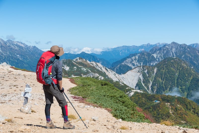
Hiking tour connectivity in Japan has a strong safety dimension. Urban tourism does not face the same requirements.
For adventure operators, mobile connectivity can support several critical activities. These include weather monitoring, emergency communication, navigation checks, and group location sharing.
As a result, operators should plan connectivity as part of their safety system.
Weather Monitoring
Mountain weather in Japan can change rapidly. Therefore, guides need access to current weather information before and during a hike.
Japan’s mountain weather services include JMA mountain forecasts, Yamatenki, and Tenki-to-kurasu. Guides can use these services to monitor changing conditions.
For example, a guide may check a 12-hour mountain forecast before ascending a ridge. In this situation, connectivity supports a safety decision rather than simple convenience.
Emergency Communication
Injuries, altitude sickness, and severe weather can create emergency situations.
A guide may need to contact emergency services or coordinate an evacuation. Emergency calls such as 110 and 119 do not depend on mobile data in the same way that apps do.
However, data can still support other parts of an emergency response. These include GPS location sharing, text communication, operator updates, and medical translation.
Therefore, reliable connectivity remains important even when voice calls are the primary emergency tool.
Navigation Verification
Japanese mountain trails are generally well marked. However, conditions can change.
Weather can damage trails. Seasonal closures can also affect routes. Therefore, guides may need to verify current trail information before continuing.
Offline maps should always be prepared first. Nevertheless, mobile connectivity at trailheads, huts, and other coverage points can provide useful updates.
Group Location Tracking
Guides cannot always maintain visual contact with every group member. This is especially true on longer or more difficult trails.
Location-sharing applications can provide an additional safety layer. However, these services require data when the group is within mobile coverage.
Consequently, guides should combine location sharing with offline navigation and clear group procedures.
Rural, Mountain, and Trail Coverage
The Honest Coverage Assessment
The most important coverage point for adventure operators is simple: no carrier provides reliable data coverage at every elevation and on every trail in Japan.
Mountain coverage depends on base-station placement and terrain. Networks are generally designed around populated areas and transport corridors rather than every hiking trail.
Therefore, operators should never promise continuous connectivity in the mountains.
Docomo Adventure Coverage
Docomo provides the broadest coverage option for many rural and mountain environments in Japan. This makes it the recommended network for adventure and hiking programs in this playbook.
Several factors support this recommendation.
JR-Adjacent Trail Corridors
Many Japanese hiking destinations are reached through regional JR rail corridors.
Docomo’s coverage along these transport routes can also extend into approach areas near major hiking destinations.
Therefore, guides can often maintain connectivity during the journey toward a trailhead.
Mountain Hut Coverage
Japan has an extensive network of mountain huts, known as yamagoya.
Many huts in heavily used alpine areas fall within Docomo coverage range. These include parts of the Japan Alps and other major hiking regions.
Coverage can still be intermittent. However, mountain huts can provide useful points for checking messages and sending updates.
National Park Approach Areas
Trailhead villages, visitor centers, and lower mountain areas often have better connectivity than remote trail sections.
Docomo coverage in these approach areas can therefore support trip preparation. Guides can check weather conditions and trail information before entering more remote terrain.
Docomo Limitations
Docomo does not provide continuous coverage across all Japanese trails.
Deep mountain areas, remote ridges, and backcountry routes can have coverage gaps. Examples include parts of Shirakami-Sanchi, Daisetsuzan, and remote sections of the Shikoku 88 Temple route.
Therefore, guides should expect coverage gaps rather than assume that Docomo provides trail-wide service.
SoftBank and KDDI in Adventure Environments
SoftBank and KDDI can provide adequate service in many urban and developed tourism areas. However, their coverage may be less consistent in remote mountain environments.
Adventure groups may still have service in trailhead villages and developed alpine resorts. Kamikochi and some Hakuba routes are examples.
However, coverage can become less reliable farther along remote trails.
Network Recommendation
Docomo is the recommended network for adventure and hiking Japan tour programs.
This recommendation reflects the importance of rural and mountain coverage. It does not mean that Docomo provides service everywhere.
Operators should still prepare for coverage-free sections.
Key Adventure Destinations
Japan Alps
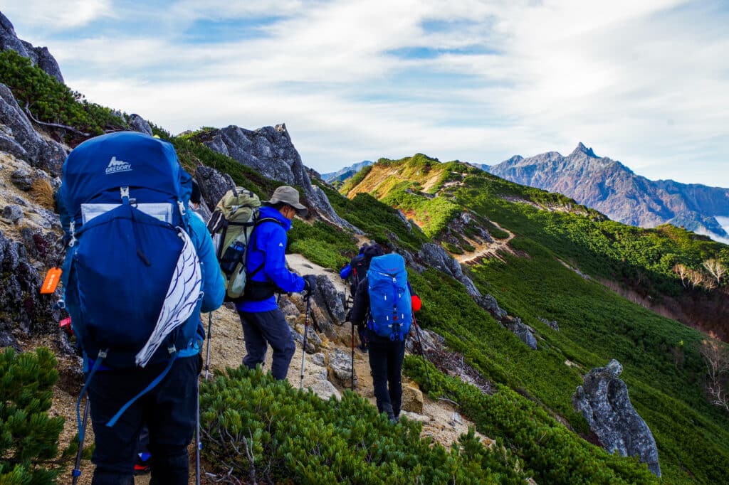
The Japan Alps contain some of Japan’s best-known alpine destinations. These include Kamikochi, the Kita Alps, Yarigatake, and Hotakadake.
Coverage profile: Kamikochi’s valley floor and visitor center generally have adequate Docomo coverage.
Major mountain huts can also have intermittent Docomo service in favorable conditions. However, summits and high ridges may have unreliable or absent coverage.
Operational guidance: Guides should download offline maps and weather information before entering the alpine zone.
They should also use mountain huts and other coverage points to check conditions. These locations can also be used to send updates to the tour operator.
Kumano Kodo
The Kumano Kodo routes run through the mountains of the Kii Peninsula. Major routes include Nakahechi, Kohechi, and Ohechi.
The routes combine hiking with cultural experiences. Therefore, connectivity can support both safety and cultural interpretation.
Coverage profile: The main route villages and key waypoints generally have adequate Docomo coverage. Deep forest sections can have variable service.
Operational guidance: Docomo is recommended for Kumano Kodo programs.
In addition, cultural sites along the route can create translation needs. Guides may need data for information boards, shrine context, and temple explanations.
Hokkaido Backcountry
Daisetsuzan National Park and the Shiretoko Peninsula represent some of Japan’s most remote adventure environments.
Coverage profile: Coverage is limited in the interior of Daisetsuzan and wilderness areas around Shiretoko.
Docomo provides the strongest option among the listed carriers. However, long coverage-free sections should still be expected.
Satellite Communication for Remote Areas
For genuinely remote Hokkaido routes, an eSIM should not be treated as the only communication system.
Operators should consider a satellite communication device such as Garmin inReach or an equivalent service.
The eSIM can support connectivity in approach areas and nearby towns. Meanwhile, satellite communication can provide an additional emergency option in areas without terrestrial mobile coverage.
Shikoku 88 Temple Pilgrimage
The Shikoku Ohenro route circles Shikoku Island. It combines mountain sections, rural roads, temples, and cultural experiences.
Coverage profile: Urban temple approaches in Kochi and Matsuyama generally have good coverage.
Mountain sections in Kochi and Ehime can have variable Docomo service. Rural valleys may also have limited coverage.
Operational guidance: Docomo is recommended for Shikoku pilgrimage programs.
However, operators should plan for coverage-free mountain sections. This is normal for remote trail environments.
Guide, Staff, and Client eSIM Plans
Guide Safety Plan Requirements
The guide’s eSIM is the highest-priority connectivity specification for an adventure tour.
Guide connectivity supports safety operations. Therefore, it should not be treated as a standard client convenience.
Recommended Guide Setup
Adventure tour guides should have:
- Unlimited Docomo data to avoid data-management restrictions.
- Emergency numbers saved before departure.
- JMA mountain weather services installed or bookmarked.
- Offline maps downloaded for every planned trail.
- Location sharing enabled with the tour operator during multi-day routes.
This setup gives guides several layers of preparation.
Most importantly, offline resources remain available when mobile coverage disappears.
Staff Plan Requirements
Trail coordinators and base-camp staff can use a 20GB Docomo plan for coordination, weather monitoring, and communication.
Transfer and logistics staff can use a 15GB Docomo plan for navigation and communication.
These plans provide different levels of data according to each staff member’s role.
Client Plan Requirements
Adventure clients generally have moderate data needs in mountain environments.
Their main uses include photography sharing, family messaging, weather checks, research, and mapping.
Client Data Consumption
Typical estimated use includes:
- Mountain photography sharing: 500MB–1GB on days with connectivity.
- Family messaging: 50–100MB per mountain-hut stop.
- Weather monitoring: 50–100MB per day.
- Research and mapping: 100–200MB per day.
Therefore, estimated daily consumption can reach 1–2GB on days with meaningful connectivity.
On deep mountain sections without coverage, mobile data consumption may be close to zero.
Recommended Client Plans
A 15GB Docomo plan is suitable for most adventure clients on programs of up to 10 days.
For programs lasting 14 days or longer, a 20GB plan can provide additional capacity.
Unlimited can also suit clients who regularly share large numbers of photographs.
Safety, GPS, and Emergency Connectivity
Offline Navigation First
Adventure tour operators should never make continuous mobile coverage a requirement for navigation.
Instead, guides should download maps before reaching the trailhead.
Google Maps offline areas can provide a basic navigation resource. For serious hiking, apps such as Yamap and Geographica can provide trail-specific information.
These tools can include trail markings, elevation information, and mountain-hut locations.
Therefore, all essential navigation resources should be available offline before the hike begins.
Use Connectivity at Access Points
Trailheads, base areas, villages, and mountain huts can become important connectivity points.
When service is available, guides can download updated weather forecasts. They can also check trail information and send location updates.
As a result, guides can make better use of limited coverage.
The key principle is simple: use mobile data when it is available, but never depend on it continuously.
Emergency Data Infrastructure
Essential Pre-Departure Setup
Adventure guides should prepare the following before departure:
- Safety Tips or relevant official emergency resources.
- JMA mountain weather information.
- Emergency numbers, including 119.
- Offline first-aid references.
- Offline trail maps.
- Relevant location-sharing tools.
These resources should be tested before the group reaches the trailhead.
Japan Mountain Rescue
Japan’s mountain rescue response involves local police and fire departments.
Emergency assistance can be reached through 110 and 119. However, guides should understand that data and voice coverage can behave differently in remote areas.
Therefore, emergency preparation should never depend only on an eSIM.
Satellite Device Recommendation
For remote Hokkaido, Shiretoko, and Daisetsuzan programs, operators should consider a satellite messenger.
Garmin inReach or an equivalent device can supplement the eSIM.
The eSIM supports communication where terrestrial coverage exists. The satellite device provides another communication option in coverage-free areas.
Bulk Pricing and Network Selection
Volume Calculation for Adventure Operators
Adventure tour operators often run smaller groups than cultural or city-circuit operators.
A typical departure may include 8–15 clients. However, operators may run programs across several seasons.
For example:
- 15 departures × 12 clients = 180 client activations
- Additional guide and staff activations increase annual volume.
- Dedicated Japan adventure operators may reach around 200–250 annual activations.
This level of volume can support entry-to-mid-tier wholesale pricing.
Planning Wholesale eSIM Requirements
Adventure operators should discuss several factors when planning wholesale connectivity.
These include:
- Docomo network specifications.
- Unlimited plans for guides.
- Client plan sizes.
- Annual activation volume.
- Seasonal departure schedules.
Therefore, annual volume should be considered when assessing wholesale pricing.
Why Network Selection Matters More
For urban tours, network selection is often a preference.
A traveler may choose one carrier for rural reach or another for urban performance. In most city itineraries, the practical consequences are limited.
Adventure tours are different.
A guide may enter an area where connectivity is limited. At that point, network selection can affect the availability of communication and online safety resources.
Therefore, network selection becomes part of operational risk management.
Docomo is the recommended specification for the adventure and hiking programs covered in this guide.
However, operators should still communicate that no terrestrial carrier provides continuous mountain coverage.
Conclusion: Docomo, Unlimited for Guides, Offline Maps First
The Japan eSIM for adventure tours framework is more prescriptive than many other tourism programs.
The reason is straightforward. Adventure tours operate in environments where connectivity can support safety, communication, navigation, and weather monitoring.
Docomo is the recommended network for these programs.
Unlimited Docomo is recommended for guides because their data needs can change quickly during a mountain day.
15GB Docomo is suitable for many clients on trips of up to 10 days. Longer programs may require 20GB or unlimited plans.
Most importantly, operators should download offline maps and weather resources before entering remote areas.
Emergency contacts should also be saved in advance. For the most remote environments, satellite communication should supplement the eSIM.
Japan Sim Data’s adventure-tour support can provide coverage context, guide safety materials, plan recommendations, and wholesale pricing support.
Together, these measures create a stronger connectivity framework for professional adventure tour operators in Japan.
Visit Japan Sim Data to discuss your adventure tour eSIM program.
Frequently Asked Questions
Does any carrier provide reliable trail coverage throughout Japan’s mountain environments?
No carrier provides continuous coverage across every Japanese mountain trail.
Docomo provides the broadest coverage option among the carriers discussed in this guide. It can be useful around trailhead villages, national park approach areas, and major mountain-hut locations.
However, remote trails can still have coverage gaps.
Therefore, operators should use offline maps and consider satellite communication for the most remote programs.
What should guides do when they lose coverage on the trail?
Guides should expect some coverage-free sections.
Before entering these areas, they should download maps, weather information, and relevant trail information.
They should also communicate their route and expected return times to the appropriate operator or support team.
Emergency communication should not depend entirely on mobile data.
Is an eSIM alone sufficient for remote Hokkaido or Shiretoko?
No. For the most remote backcountry environments, an eSIM should not be the only communication solution.
Daisetsuzan and Shiretoko can contain long areas without terrestrial mobile coverage.
Therefore, professional operators should consider a satellite messenger such as Garmin inReach or an equivalent device.
Why is unlimited data recommended for guides?
Guide data use can vary significantly during a mountain trip.
Weather monitoring may increase when conditions change. Location sharing can also run throughout the day.
In addition, guides may need online research or communication during coverage periods.
Therefore, unlimited data removes the need to manage consumption during safety-related activities.
How should operators communicate coverage limitations to clients?
Operators should explain the limitations before departure.
Clients should understand that mountain and trail sections can have limited or no mobile coverage.
They should download offline maps before beginning each trail section. Operators can also explain that mountain huts and trailhead villages may provide useful connectivity points.
As a result, clients can plan family communication around available coverage rather than expecting continuous service.
What is the best eSIM plan for adventure tour clients?
A 15GB Docomo plan is suitable for many clients on trips of up to 10 days.
For longer programs, 20GB provides additional capacity. Unlimited can suit clients who frequently upload photographs or use large amounts of mobile data.
The final choice should depend on trip length, WiFi access, and expected usage.
Should guides have a different eSIM plan from clients?
Yes.
Guides have more demanding connectivity responsibilities. They may monitor weather, use navigation tools, share locations, communicate with operators, and handle unexpected situations.
Therefore, Unlimited Docomo is recommended for guides, while fixed plans can be suitable for most clients.
Should offline maps be mandatory for adventure tours?
Yes.
Mobile coverage can disappear without warning in mountain environments.
Therefore, guides should download all essential maps before reaching the trailhead. Offline navigation provides an important backup when mobile data becomes unavailable.