

Okinawa eSIM: Best Plans for Naha, Ishigaki, and the Yaeyama Islands

Okinawa is Japan’s tropical anomaly — a subtropical archipelago stretching over a thousand kilometers of Pacific and East China Sea, with a culture, cuisine, and natural environment distinct enough from mainland Japan that many visitors feel they’ve arrived somewhere altogether different. The coral reefs of the Yaeyama Islands are among Asia’s finest dive destinations. The beaches of Miyako-jima are among the most beautiful in the entire Pacific. And the main island of Okinawa — with its Ryukyuan history, distinctive food culture, and the complicated legacy of its wartime past — offers depth of experience beyond what its beach-destination reputation fully conveys.
The okinawa esim question is one of the more genuinely complex connectivity planning exercises in Japan travel, because Okinawa Prefecture encompasses an extraordinary geographic range. The main island is a conventional urban-to-beach transition with good coverage infrastructure. The outlying islands — Ishigaki, Miyako, Iriomote, Yonaguni, and dozens of smaller inhabited and uninhabited islands — each have their own coverage profiles, their own infrastructure constraints, and their own connectivity realities for the traveler who ventures beyond Naha.
This guide covers every dimension of Okinawa connectivity: main island coverage, remote island realities, the specific needs of divers and beach travelers, data-heavy scenario planning, and the Japan Sim Data plan configuration that best serves the full range of Okinawa travel experiences.
Okinawa’s Tourism Boom and Connectivity Needs
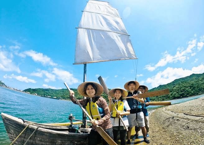
Okinawa’s inbound tourism has grown dramatically, driven by strong demand from mainland Japan, Korea, Taiwan, China, and increasingly Western markets discovering the Yaeyama Islands’ diving credentials. This tourism expansion has driven meaningful telecommunications infrastructure investment — coverage across main Okinawa island is now substantially better than it was a decade ago, and Ishigaki’s development as a tourism hub has brought significantly improved connectivity to the Yaeyama gateway.
The okinawa travel esim decision sits at the intersection of this improving infrastructure and the persistent reality that remote island chains at Japan’s southwestern edge remain subject to coverage constraints that no carrier has fully resolved. Understanding where coverage is reliable, where it is partial, and where it is genuinely absent is the honest starting point for Okinawa connectivity planning.
Mobile Coverage Across Main Okinawa Island
Main Okinawa island — running roughly 110 kilometers from the northern Cape Hedo to the southern Peace Memorial Park — has coverage profiles that vary significantly between the densely developed south and central regions and the more rural and forested north.
Southern and Central Okinawa (Naha to Okinawa City)
The naha esim area and the central Okinawa corridor — encompassing Naha’s urban core, Kokusai-dori street, the Shurijo Castle area, American Village in Chatan, and Okinawa City — has comprehensive coverage across all three major carriers. This is the most visited part of the main island, and the telecommunications infrastructure reflects that tourism and residential density.
All three carriers provide strong 4G LTE connectivity throughout this corridor. For travelers concentrating their Okinawa experience in Naha and the central beach resorts — the Onna Village resort strip, the beaches of Chatan, Moon Beach, and Manza — any Japan Sim Data network performs well.
Northern Main Island and Yambaru
The northern third of main Okinawa island — the Yambaru forest area, the Motobu Peninsula (home to the Churaumi Aquarium), and Cape Hedo at the island’s northern tip — transitions from adequate coverage in populated areas to more variable coverage in the forested interior.
The Motobu Peninsula and the Ocean Expo Park area (Churaumi Aquarium) has coverage adequate for navigation and messaging across all carriers. The Yambaru National Park interior — a UNESCO World Heritage forest ecosystem of exceptional biodiversity — has more limited coverage. docomo okinawa coverage extends into the Yambaru area more reliably than softbank okinawa or kddi okinawa in the forest interior, consistent with Docomo’s national rural coverage advantage.
Remote Island Coverage: Ishigaki, Miyako, Iriomote, and Yonaguni
Ishigaki Mobile Data
ishigaki mobile data is the most important remote island connectivity question for Okinawa travelers, given Ishigaki’s role as the hub of the Yaeyama archipelago. The island receives approximately 1.4 million visitors annually and has seen significant telecommunications infrastructure development to match this visitor volume.
Ishigaki city and the main island circuit road have adequate Docomo coverage for navigation, messaging, and moderate social sharing. The famous Kabira Bay — one of Japan’s most photographed beaches — is accessible and covered. The road circuit around the island passes through areas of variable coverage, with Docomo most consistently performing in the rural sections.
As the departure point for ferries to Iriomote, Kohama, and other Yaeyama islands, Ishigaki’s connectivity is the anchor from which travelers venture into progressively less-covered territory. Docomo is the network specification for Ishigaki-based itineraries extending to the outer islands.
Miyako eSIM
miyako esim planning covers an island that has emerged as one of Japan’s premier beach destinations — its white sand beaches (Sunayama, Yonaha Maehama, Yoshino) and extraordinary shallow turquoise water have attracted travelers and travel media attention that has made Miyako-jima one of the most recognizable beach images in Japanese tourism.
Miyako-jima town and the main beach corridors have Docomo coverage that supports connectivity for the majority of visitor activities. The island’s road circuit — connecting the beaches and the bridges to the smaller surrounding islands of Irabu-jima and Shimoji-jima — has variable coverage, with Docomo most reliably maintaining signal throughout.
For divers using Miyako’s exceptional marine environments — including the famous Toriike Blue and White tidal pools on Ikema-jima — surface connectivity between dives is supported by Docomo coverage in the main dive site access areas.
Iriomote Connectivity
iriomote connectivity presents the most challenging remote island scenario in the Yaeyama group. Iriomote-jima — a large, heavily forested island where over 90% of the land is covered by subtropical jungle — is simultaneously one of the most extraordinary wildlife experiences in Japan and one of the least-connected destinations.
The island’s two main villages (Ohara in the east, Uehara in the northwest) have Docomo coverage adequate for messaging and basic navigation. The jungle rivers, hiking trails, waterfalls, and mangrove ecosystems that make Iriomote exceptional are largely outside reliable mobile coverage. The popular Urauchi River kayaking and jungle trekking experience moves through terrain where connectivity is absent regardless of carrier.
Iriomote visitors should: download offline maps for the entire island before crossing from Ishigaki; not rely on mobile navigation in the jungle interior; and treat the island experience as appropriately offline in its natural sections — which is, in many ways, exactly as it should be.
Yonaguni
Japan’s westernmost island — closer to Taiwan than to mainland Okinawa — offers connectivity at Yonaguni village and the main coastal settlements, with Docomo providing the most reliable of the limited coverage options. Yonaguni is primarily visited for its world-famous diving (the underwater ruins and school of hammerhead sharks are bucket-list dive experiences) and its end-of-Japan isolation appeal.
Connectivity at Yonaguni should be treated as occasional and supplementary rather than reliable — the island’s distance from major infrastructure makes this a genuinely remote connectivity environment.
eSIM Tips for Divers, Beach Travelers, and Remote Workers
For Divers
The esim for okinawa divers use case is specifically about surface connectivity — what happens between dives, at the dive shop, and in the evenings at Ishigaki or Miyako accommodation. Underwater, no connectivity solution is relevant.
Key diver connectivity needs: dive shop communication (many Okinawa dive operators communicate primarily via LINE for booking confirmations and pickup coordination); weather and sea condition checking (critical for dive planning, particularly in the Yaeyama and outer islands where conditions change rapidly); and navigation to less-known dive sites when self-organizing transport.
Docomo coverage at the main dive hubs — Ishigaki City, Miyako-jima port area, Iriomote’s village areas — supports all of these functions. The Docomo network recommendation for divers is about reliability at exactly the surface-level moments between diving when connectivity matters most.
For Beach Travelers
The japan esim beach traveler’s connectivity needs center on navigation between beaches, restaurant discovery, and social sharing from beach locations. Beach connectivity at Okinawa’s main tourist beaches — Naha-adjacent beaches, Onna Village resort beaches, Ishigaki’s main beaches, Miyako’s celebrated sandy corridors — is generally adequate on Docomo and variable on other carriers.
The esim tropical japan beach experience is most reliably served by Docomo for beach locations outside the main resort corridors, where coverage infrastructure thins alongside visitor density.
For Remote Workers in Okinawa
The japan nomad okinawa connectivity reality has been covered in the digital nomad guide, but the Okinawa-specific note is that connectivity for remote work is reliably supported in Naha (multiple co-working spaces, strong urban network across all carriers) and decreasingly reliable as itineraries extend to the outer islands. Remote workers using Okinawa as a base should plan their work periods around Naha or Ishigaki city for fiber WiFi access, with mobile eSIM supplementing connectivity during island exploration outside working hours.
Data-Heavy Scenarios in Okinawa

Video Calls from Remote Islands
The okinawa mobile data reality for video calls from remote island locations varies significantly by position. From Ishigaki city accommodation: reliable enough for standard video calls on Docomo. From Iriomote village: variable but possible on Docomo in favorable conditions. From Yonaguni: intermittent and not reliably supported for work-critical video calls.
Managing video call scheduling around your island itinerary — booking important calls for Ishigaki city days rather than Iriomote jungle days — is the practical approach to video call reliability in the Yaeyama island-hopping context.
Photo and Video Uploads
Okinawa’s visual beauty drives high photo and video upload demand — the underwater colors, the beach scenery, the sunset shots from Cape Hedo, the mangrove reflections in Iriomote. The upload timing reality in Okinawa mirrors advice for other Japanese natural destinations: high-bandwidth uploads are best executed from hotel or accommodation WiFi in the evenings rather than consuming eSIM data during active tourism hours.
Streaming and Entertainment
Ferry crossings between Okinawa islands — Naha to Ishigaki takes approximately twelve hours by overnight ferry; Ishigaki to Iriomote is forty-five minutes to an hour — represent periods where streaming entertainment over mobile data is practical for some crossings and WiFi-dependent for others. Pre-downloading entertainment content before longer ferry crossings is the practical preparation for ocean transit segments where coverage may be intermittent.
Choosing the Right Japan Sim Data Okinawa Plan
For Main Island Okinawa Visitors
Travelers concentrating their Okinawa experience on the main island — Naha, the central beach resort corridor, and the Motobu Peninsula — are well-served by any Japan Sim Data network on a standard fixed-data plan (10–15GB for a seven-to-ten day trip). The prepaid esim okinawa option at this level covers urban navigation, restaurant discovery, beach social sharing, and accommodation research without requiring unlimited data.
SoftBank and Docomo both perform well on main island Okinawa; KDDI is also adequate for the main tourist corridor.
For Yaeyama Island Hoppers
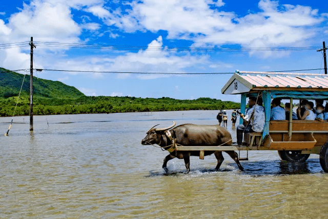
The japan esim island hopping itinerary covering Ishigaki, Miyako, Iriomote, and potentially Yonaguni requires a Docomo-network plan without exception. The outer islands’ coverage reality makes any other carrier a genuine liability for navigation and communication reliability.
Data sizing for Yaeyama island hoppers should account for the photography-intensive nature of this itinerary — the beaches, reefs, and wildlife generate social media content at high rates. A 20GB fixed plan or unlimited plan on Docomo is the appropriate specification for a Yaeyama island circuit.
For Divers and Water Sports Travelers
The okinawa data plan for divers should be sized around the surface connectivity pattern: moderate navigation and communication during the day, photography sharing and weather checking in the evenings. A 15GB Docomo plan covers the typical week-long Okinawa diving trip; heavy content creators producing underwater photography or video content should consider unlimited for the upload volume.
According to the Japan National Tourism Organization (JNTO), Okinawa Prefecture consistently generates the highest satisfaction ratings among inbound Japan destination visitors, with nature tourism, beach experiences, and diving cited as primary motivators. The GSMA identifies island tourism eSIM as a rapidly growing category, with coverage reliability in remote island environments the primary selection criterion for this traveler segment.
Conclusion: Japan’s Tropical South Needs the Right Network
Okinawa’s connectivity planning is more geography-specific than most Japan destinations — the difference between Docomo and other carriers is most pronounced in exactly the places that make Okinawa most memorable. The main island’s resort corridor? Any network works. Iriomote’s jungle rivers? Only Docomo gives you coverage in the village areas between the truly offline wilderness. Yonaguni’s dive sites? Plan for connectivity as a welcome surprise rather than a reliable given.
The okinawa connectivity guide conclusion is consistent with the broader Japan remote destination message: Docomo for any itinerary that extends beyond the main urban and resort corridors, and a data allocation sized to match the photography and communication demands that Okinawa’s extraordinary natural beauty inevitably generates.
Japan Sim Data’s Docomo-network eSIM plans for Okinawa and the Yaeyama Islands are available at wordpress-1493298-6069223.cloudwaysapps.com — install before departure, download offline maps for each island, and arrive in Japan’s subtropical south ready for the connectivity reality that its remote archipelago geography creates.
Frequently Asked Questions
Q1: Does mobile data work on the beaches in Okinawa?
A: Most of Okinawa’s main tourist beaches — on the main island and in Ishigaki and Miyako — have Docomo coverage adequate for messaging and moderate social sharing. More remote beaches, particularly on Iriomote and smaller outer islands, may have no coverage. Docomo provides the most consistent beach connectivity across the full Okinawa archipelago.
Q2: Can I get online on the ferry from Naha to Ishigaki?
A: The overnight ferry from Naha to Ishigaki passes through areas of variable coverage. Docomo provides the most consistent connectivity during the ferry crossing, but coverage should be treated as intermittent rather than reliable throughout. Pre-downloading entertainment content before boarding is recommended for the longer overnight crossing.
Q3: Is there connectivity for diving in the Yaeyama Islands?
A: Surface connectivity at Yaeyama dive hubs — Ishigaki city, Miyako port, Iriomote village areas — is supported by Docomo for dive shop communication, weather checking, and navigation. Underwater connectivity is not applicable to any mobile solution. Specify Docomo for the most reliable surface connectivity between dives.
Q4: What data plan size do I need for a two-week Okinawa island-hopping trip?
A: A two-week Yaeyama island-hopping itinerary involving active photography, dive shop communication, navigation across multiple islands, and regular social sharing typically requires 20GB or more. Unlimited Docomo plans eliminate data management anxiety for this itinerary type and are the recommended specification for comprehensive Okinawa island exploration.
Q5: Does Docomo cover Yonaguni Island?
A: Docomo provides limited coverage at Yonaguni’s main village and coastal settlements — the most reliable coverage available on Japan’s westernmost island, though still subject to the infrastructure constraints of a very remote location. Do not rely on consistent connectivity at Yonaguni; download offline maps and entertainment before the flight from Ishigaki.