

Google Maps Japan Travel: Use It Like a Local With Data Tips

For first-time visitors, Japan can seem difficult to navigate. Tokyo’s railway network has multiple operators, huge stations can have dozens of exits, and even a simple walk can take you through a maze of small streets. This is where Google Maps Japan travel becomes one of the most useful tools on your phone.
Google Maps can help you find train routes, walking directions, restaurants, hotels, convenience stores, attractions, and even specific station entrances. With a reliable mobile connection, you can update routes while moving around Japan and react when plans change.
However, using Google Maps effectively in Japan is slightly different from using it at home. Public transportation is a major part of everyday travel, and choosing the right train, platform, transfer, or station exit can make a significant difference to your journey.
This guide explains how to use Japan Google Maps more effectively, when offline maps can help, how to use train and bus directions, what affects your data consumption, and how a Japan Sim Data eSIM can support map-heavy travel.
Where Google Maps Excels and Where It Can Stumble
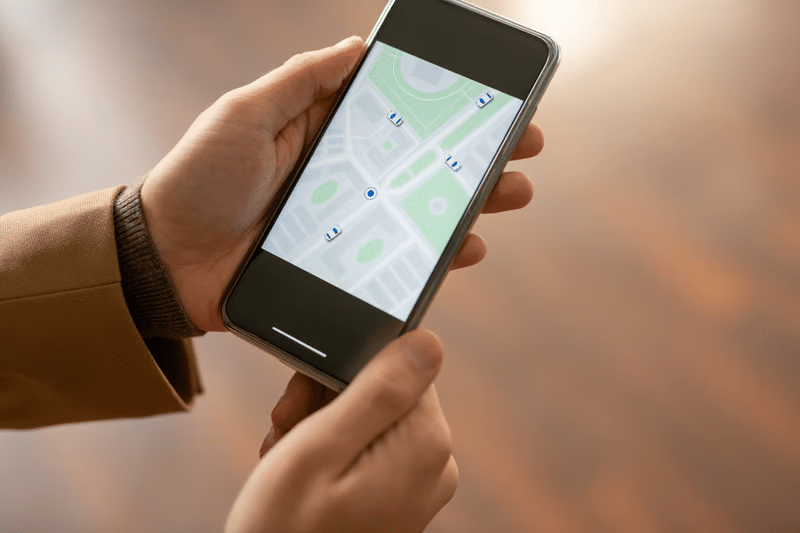
Google Maps is an excellent general-purpose navigation tool for Japan, but it is not perfect. Knowing what it does well—and where you should double-check information—can make your journey much smoother.
What Google Maps does well in Japan
For most international travelers, Google Maps is particularly useful for five things:
- Walking directions
- Train and subway route planning
- Finding restaurants and attractions
- Locating hotels and businesses
- Recalculating routes when plans change
The walking function is especially valuable in Japanese cities. A destination that looks close on the map may be separated from you by a railway line, river, large building, or complicated intersection.
Google Maps can help identify a practical walking route instead of simply showing the shortest straight-line distance.
It can also provide information about opening hours, reviews, photos, addresses, and popular places nearby. This makes it useful for spontaneous travel.
Station navigation requires attention
Japanese train stations can be enormous. Tokyo Station, Shinjuku Station, and other major hubs can take time to understand, particularly when you are transferring between different railway operators.
Google Maps can tell you which station to use and which train to take, but do not automatically assume that the first route displayed is the easiest one for you.
Check:
- The railway operator
- Train line
- Departure time
- Platform information when available
- Number of transfers
- Walking time between stations
- Destination station
- Whether an express or local train is recommended
A route with one fewer transfer is not always easier if it involves a long walk between platforms.
Where it can stumble
Google Maps relies on constantly updated information, and public transportation schedules can sometimes change.
Temporary railway disruptions, service suspensions, construction, weather-related delays, or special events can affect your journey.
When something unusual happens, check official railway information as well. This is particularly important when traveling long distances or trying to catch a reserved train.
For general sightseeing, however, Google Maps remains a powerful Japan navigation app.
Downloading Offline Maps
One of the smartest things you can do before your trip is prepare Japan offline maps.
Offline maps can be useful when you temporarily lose connectivity, have poor reception, or want to reduce the amount of mobile data used by map browsing.
Google Maps supports downloading areas for offline use where the feature is available. You can select an area, download it while connected to Wi-Fi, and use the stored map information later.
How to prepare your offline map
Before flying to Japan:
- Open Google Maps while connected to Wi-Fi.
- Search for the Japanese city or region you will visit.
- Open the offline maps feature.
- Select the area you want to save.
- Download the map.
- Check that it appears in your offline maps.
- Repeat for other major areas on your itinerary.
If you are visiting Tokyo, Kyoto, Osaka, and Hiroshima, for example, consider downloading the areas you expect to use rather than relying on one huge map.
Know the limitations
Offline maps are useful, but they should not be treated as a complete replacement for internet access.
Live traffic conditions, updated transit information, business information, some route features, and other online functions may require connectivity.
Public transportation is particularly important. A stored map can show you where a station is, but it may not provide the latest information about a delayed train or a changed service.
For this reason, the best strategy is usually a combination of offline preparation and reliable mobile data.
Use offline maps as a backup
Think of offline maps as your safety net.
If you are walking through a neighborhood and your signal becomes temporarily weak, you can still have basic geographic information available. If your phone is connected normally, however, you can take advantage of Google’s live features.
This approach gives travelers the benefits of both preparation and flexibility.
Using Train and Bus Directions
Public transportation is where Google Maps becomes especially valuable for international visitors.
Japan’s trains and buses are extensive, but different cities and operators can make the system seem complicated. Google Maps helps convert that complexity into a step-by-step route.
Start with your exact destination
Instead of searching for a neighborhood, search for the actual destination.
For example, if you are visiting a restaurant in Shibuya, enter the restaurant name or address rather than simply searching for “Shibuya.”
Google Maps can then guide you from your current location to the specific destination.
This matters because large areas often contain multiple stations and entrances.
Check the complete route
When Google Maps gives you several options, compare them.
Look at:
- Total journey time
- Number of transfers
- Walking time
- Departure time
- Train line
- Arrival station
- Fare information when available
A route that saves five minutes but requires two complicated transfers may not be better than a slightly longer direct route.
Understand Japanese station names
One useful trick for Japan travel directions is to pay attention to station names in both English and Japanese.
Japanese signs commonly display station names in Japanese characters alongside Romanized names. Familiarizing yourself with the station’s name can make it easier to match your Google Maps instructions with the signs around you.
If you see several similar station names, do not rush. Confirm the railway line and destination before entering the platform area.
Buses need extra attention
Google Maps can be useful for buses, but bus systems vary significantly between Japanese cities.
In Kyoto, for example, buses can be extremely useful for reaching attractions that are not directly next to subway stations. However, busy routes can become crowded, and the correct stop matters.
When using bus directions:
- Check the bus stop name.
- Confirm the route number.
- Check the direction of travel.
- Watch the estimated departure time.
- Confirm your destination stop.
- Follow local signs when boarding.
Having a live connection can make it easier to adjust your plan if the estimated arrival time changes.
Use station exits intelligently
This is one of the easiest ways to make your Japan trip less stressful.
A large station may have several exits, and choosing the wrong one can add significant walking time.
When Google Maps shows an exit or nearby landmark, pay attention to it before leaving the station.
If you are meeting someone, sharing the exact station exit can be much more useful than simply saying, “I’m at Shinjuku Station.”
Data Usage Estimates for Map-Heavy Days
Travelers often ask how much data Google Maps uses in Japan.
There is no single number that applies to every traveler because usage depends on how you use the app. Simple route checks are generally much lighter than repeatedly browsing maps, loading photos, searching businesses, and using other connected services.
Your data consumption can increase when you:
- Repeatedly search new destinations
- Browse restaurant listings
- Load photos
- Zoom and explore large areas
- Use other apps at the same time
- Share locations
- Stream music or video while navigating
- Use translation apps alongside Maps
The important point is that Google Maps is only one part of your phone’s total data consumption.
A map-heavy day
Imagine a traveler spending a full day in Tokyo.
They might:
- Check the weather in the morning.
- Use Google Maps to reach a train station.
- Search a café.
- Navigate to an attraction.
- Check another train route.
- Search a restaurant.
- Walk to dinner.
- Use translation at the restaurant.
- Navigate back to the hotel.
The total mobile data used by the day is therefore not just Google Maps. Multiple apps are communicating with the internet.
This is why travelers should consider their overall usage pattern rather than trying to calculate one exact Google Maps figure.
Ways to reduce unnecessary data use
A Japan eSIM maps strategy can include simple data-saving habits.
Download offline maps before departure, use Wi-Fi when convenient, avoid unnecessarily browsing high-resolution photos, and close apps that you do not need.
You can also prepare your itinerary in advance so that important destinations are already saved or easily searchable.
But do not become so focused on saving data that you stop using your phone when you genuinely need it. The purpose of mobile connectivity is to make travel easier.
How Japan Sim Data Plans Support Map Use

For travelers who depend heavily on navigation, reliable mobile data is an important part of the travel plan.
A Japan Sim Data eSIM provides connectivity through Japan’s major mobile networks, including NTT Docomo, SoftBank, and KDDI/au.
This can support travelers who use Google Maps throughout the day, particularly when moving between cities or exploring unfamiliar neighborhoods.
Think beyond Google Maps
Your phone may use data for many other travel tasks at the same time.
For example, you could use:
- Google Maps for navigation
- A translation app for Japanese signs
- A restaurant app for finding dinner
- A railway app for checking schedules
- A weather app for forecasts
- Messaging apps to communicate with your travel companions
This creates a broader Japan tourist connectivity maps requirement.
Your eSIM is supporting an entire travel system rather than just one map application.
Choosing a plan
Japan Sim Data offers Day Pass, Plan, and Unlimited options, allowing travelers to choose based on their itinerary and expected usage.
A traveler visiting Tokyo for a short weekend may have different needs from someone spending three weeks traveling from Tokyo to Kyoto, Osaka, Hiroshima, and rural destinations.
If Google Maps is one of your most frequently used apps, consider how often you will navigate, how much time you will spend outside Wi-Fi, and whether you will use other data-heavy services.
Docomo, SoftBank, and KDDI/au connectivity
Japan Sim Data provides eSIM options using NTT Docomo, SoftBank, and KDDI/au networks.
This gives travelers choices when preparing their Japan eSIM data maps setup.
The important thing is to select a plan appropriate for your travel pattern. A person who mostly uses offline maps and hotel Wi-Fi may have different needs from a traveler who spends all day outdoors using live navigation.
Group and agency travel
Map connectivity becomes even more important when traveling with a group.
Tour leaders, families, and groups of friends may use maps to coordinate meeting points, find restaurants, locate hotels, and stay in contact.
Japan Sim Data also offers bulk discounts and group plans for travel agencies and tour operators, helping larger groups organize connectivity before arriving in Japan.
Build a Japan Maps Toolkit Before Departure
A good Japan travel toolkit maps setup starts before you arrive.
Install Google Maps, check your account, download offline areas, and save important locations.
Consider saving:
- Your accommodation
- Major train stations
- Airports
- Planned attractions
- Restaurant reservations
- Emergency-related destinations
- Important meeting points
You can also save locations by category so they are easier to find during your trip.
Save your hotel address
Your accommodation should be one of the first saved locations.
If you arrive late at night or return after a long day, you do not want to search for your hotel from scratch.
Save the hotel in Google Maps and keep the address available in your booking confirmation as well.
Prepare for the airport
Save your arrival airport and first destination before departure.
If you are arriving at Narita or Haneda and continuing to Tokyo, prepare the route before you leave the airport.
This gives you a reference point even if you need a few minutes to activate your eSIM or connect to mobile data.
Think like a Japan-savvy traveler
A Japan eSIM savvy traveler does not simply install an eSIM and start using every app without preparation.
Instead, they combine:
- Offline resources
- Saved destinations
- Reliable mobile data
- Battery management
- Backup information
- Awareness of transport changes
This is the foundation of Japan smart travel maps.
Technology works best when it is combined with preparation.
Frequently Asked Questions
Q1: Is Google Maps good for Japan travel?
A: Yes. Google Maps is highly useful for walking directions, trains, buses, restaurants, attractions, hotels, and general navigation throughout Japan. Travelers should still verify important railway disruptions and changes through official transport sources.
Q2: Can I use Google Maps offline in Japan?
A: Google Maps supports offline map downloads for supported areas. Offline maps can provide useful geographic information without an internet connection, but some live and public transportation features require connectivity.
Q3: Does Google Maps use a lot of data in Japan?
A: Data use varies according to how you use the app. Basic navigation may be relatively light, while repeatedly browsing maps, photos, businesses, and other online content can increase usage. Your other travel apps also contribute to total data consumption.
Q4: Do I need a Japan eSIM for Google Maps?
A: You can use downloaded maps without mobile data in supported situations, but an eSIM makes live navigation, route updates, searches, and related travel services much more convenient when you are away from Wi-Fi.
Q5: What is the best way to prepare Google Maps for Japan?
A: Download relevant offline maps, save your accommodation and important destinations, familiarize yourself with major stations, and arrange reliable mobile data before departure. Keep important addresses available offline as a backup.
Conclusion

Google Maps can become one of the most valuable tools in your Japan travel kit. From navigating the enormous stations of Tokyo to finding a small restaurant in Kyoto, it can help you move confidently through unfamiliar places.
The trick is to use it strategically. Download offline maps before departure, save important destinations, compare train routes carefully, pay attention to station exits, and double-check unusual railway disruptions with official sources.
For travelers who rely heavily on live navigation, mobile data is equally important. A Japan Sim Data eSIM can help keep Google Maps and other travel services connected when you are away from Wi-Fi. With options using NTT Docomo, SoftBank, and KDDI/au networks, plus Day Pass, Plan, and Unlimited choices, you can select connectivity according to your itinerary and usage habits.
Build your Japan map guide before you fly, prepare your offline resources, and activate your eSIM when you are ready to explore. With the right combination of preparation and connectivity, navigating Japan can feel much less complicated—and much more enjoyable.